
Long White Gypsy uses affiliate links and is a member of the Amazon Services LLC Associates Program. If you make a purchase using one of these links, I may receive a small commission at no extra cost to you. See my Privacy Policy for more information.
Are you thinking of spending some time on New Zealand’s Te Araroa? Whether you’re planning a day walk, section walk or thru hike, use this list of Te Araroa FAQs to find out as much as you can about this trail before you embark on your adventure.
In no particular order, here are some of the most frequently asked questions you’re likely to ask or be asked about your short walk or long distance hike on Te Araroa.
Te Araroa FAQs.
How long does it take to hike the Te Araroa?
On average it takes 120 – 150 days to walk the entire 3,000 km length of the trail. Depending on your speed, this can average out at about 4 to 5 months.
How much does it cost to walk the Te Araroa?
The average hiker who wants to take in the full Te Araroa experience should aim to spend between NZD$7,000 to NZD$10,000 to hike the full length of the trail. But the cost to walk Te Araroa varies wildly among thru hikers, because each hiker has their own style of hiking the trail. Those who want to hike the trail for less than NZD$7,000 NZD should seriously consider if this is the right trail for them. Find out how much it cost me to hike the North Island section of Te Araroa.
How hard is Te Araroa trail?
New Zealand’s natural environment is rough and rugged, which is why Te Araroa is often described as one of the hardest long distance trails in the world. Many Te Araroa thru hikers have already completed one of the world’s other long distance trails e.g. the PCT (easier), CDT (on par) or AT(easier) in the USA or the Camino de Santiago in Spain (much easier).
To thru hike Te Araroa you need to be comfortable with:
– hiking for extended periods of time in wet, cold or muddy conditions
– hiking over rough and uneven terrain, often on steep and narrow trails which are exposed not only to the elements but which can also be high up with steep drop-offs.
– carrying a pack laden with 8-10 days worth of food through rough, uneven and steep terrain
– hiking on unstable tracks and pathways in alpine environments
– assessing changeable weather conditions and knowing when it is necessary to turn back.
When can you hike Te Araroa?
Most SOBO thru hikers will begin their Te Araroa thru hike between late October and mid November. NOBO hikers will usually start sometime in December or January. These start dates ensure you will be hiking outside of the main snowfall seasons in the North and South Island high country.
How many people have walked the Te Araroa?
Te Araroa is a very new long distance trail. Opened in 2011, it only really began receiving regular walkers from about 2012 onwards. Prior to 2017 less than 400 people walked the trail each year (350 in the 2015/16 season and 150 in the 2014/15 season). That number increased to over 1,100 walkers in 2018 and then to over 2,000 in 2019 (the year I walked the North Island). There was a drop in walker numbers over the 2020, 2021 and 2022 seasons due to covid-related lockdowns. The 2023 season saw over 4,000 people attempt to thru hike Te Araroa.
Can you bike the Te Araroa trail?
Most of the tracks on the Te Araroa route are constructed to walking standard only, making them difficult to pass with a bike (although some sections are hybrid walking & biking track). If you’re interested in an end to end traverse of NZ on a bike, check out the Tour Aotearoa website.
Where do you stay along the way?
For most of the North Island you can stay in a tent, in campsites and/or holiday parks along the way. In the South Island it’s mainly backcountry huts and campsites. Find out more about accommodation on Te Araroa here.
Should I hike solo or find a group to go with?
This is your personal preference. Each thru hiker may choose to team up with a group of people or go by themselves. The two experiences are very similar but also very different from one another. Due to the substantial number of people who attempt the trail each year, even if you choose to go solo you’re likely to encounter other thru hikers on a daily basis. SOBO thru hikers are more likely to regularly encounter other hikers than NOBO hikers who are typically walking ‘against the grain’.
What direction should I hike?
The vast majority of Te Araroa thru hikers choose to hike in a SOBO (southbound) direction from Cape Reinga to Bluff. Primarily, this is because the Te Araroa Trust’s trail notes are set up for SOBO hikers with very few NOBO (northbound) resources at the time of writing. Also, Auckland is the main port of entry for most international thru hikers. Less fit hikers may also prefer a SOBO thru hike because it has a gentler start. But there is an increasing number of NOBO hikers as the trail becomes more popular. If you’re a bit fitter and/or wish to avoid the crowds you may prefer to hike NOBO from Bluff.
Should I skip Ninety Mile Beach?
Ninety Mile Beach has a high attrition rate. The harsh nature of the terrain can force a hiker off trail for a few days or weeks, or at worst an early retirement from the season. The lack of water and shelter can cause heat related injuries, and the beach is also very exposed to harsh and bitterly cold western fronts from the Tasman Sea.
But this is by no means an excuse to skip it. For many thru hikers, Ninety Mile Beach is where they’ll meet the companions they’ll hike the rest of the trail with. And for those who are properly prepared for Ninety Mile Beach’s conditions (i.e. gaiters, sunscreen, long layers, waterproof and/or windproof layers, wide-brimmed hat, sunglasses) serious injuries and incidents can be easily avoided. Take it easy, and enjoy the experience.
What’s the longest distance between resupply points?
The Richmond Ranges in the upper South Island has the longest section between trail towns. On average thru hikers take around 10 days to hike from Havelock to St Arnaud, although some may take 6 days and others may take 12 or more. Check out my resupply locations on Te Araroa.
How easy is it to resupply along the way?
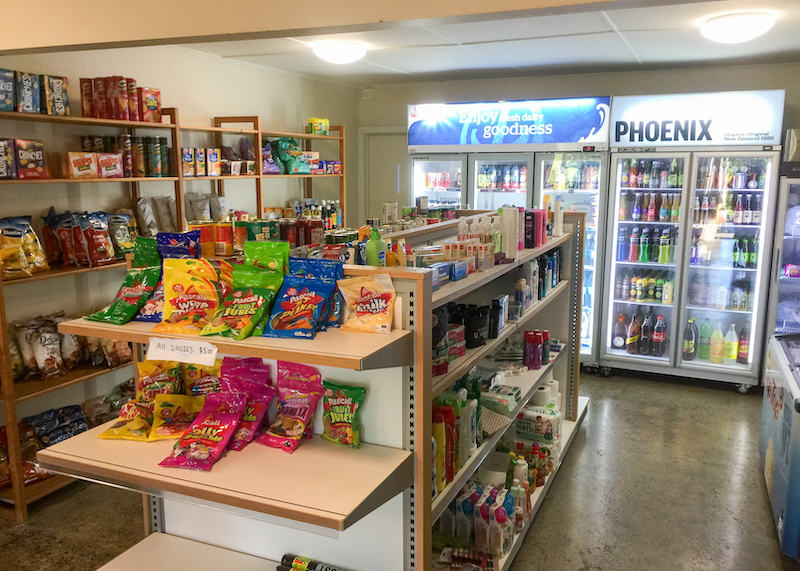
This depends on which island you’re hiking. On the North Island you’ll pass through a town every 2-3 days. Most towns will have basic supplies at a small supermarket or convenience store (known as dairies) which you can use to resupply. Larger towns have more choice.
On the South Island it will be more like 4-5 days between resupply stops and you’ll probably need to hitchhike a fair distance to get into town. You’ll have to send yourself resupply boxes to Arthur’s Pass, Boyle Village and maybe even St Arnaud as these small settlements don’t have food enough to resupply thousands of thru hikers during the busy summer tourist season. You’ll need to organise this before you leave Picton (if SOBO) or Methven (NOBO). Find out more about my resupply strategy on Te Araroa.
What happens if you get seriously hurt or injured on the trail?
Much of the trail (especially in the South Island) passes through very remote wilderness where you can often be days from the nearest road. The terrain is rough and rugged and injuries are common. If you’re embarking on this thru hike you must carry a Personal Locator Beacon with you at all times so you can call for emergency services if necessary. As long as it is a genuine emergency (i.e. you can’t safely walk yourself out, you don’t have enough food to wait, or your life is in danger) you don’t have to pay for your evacuation.
How much food should I plan to carry through each section?
As you walk, you should always check ahead to see where your next resupply location will be. On most parts of the North Island you can get away with carrying 2-3 days food at a time, although there are one or two sections where you’ll need food for 5 days or more (e.g. Whanganui River and Tararua Ranges). On the South Island, most resupply locations will be at least 5 days from the previous supply point, but there are one or two longer sections which require more planning (e.g. the Richmond Ranges and through the Nelson Lakes). Find out more about my resupply strategy on Te Araroa.
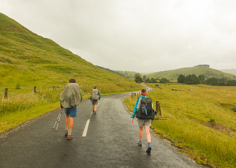
Do I have to hike all the road walking sections?
Te Araroa is a very flexible long distance trail, and even has entire sections which can be kayaked, biked or canoed to fully experience what NZ has to offer. There’s no official certificate for completing Te Araroa so it’s up to you to decide what constitutes ‘completion’ for you.
You might prefer a purist thru hike of every single kilometre including the road walks. Or you might prefer to enjoy only the wilderness aspects of the trail and skip the road sections.
Although many despise them, it’s often on the road walks where you’ll have unique encounters with the locals and get to experience good kiwi hospitality. Whatever you do, don’t decide before you set foot to trail. Keep an open mind, and wait until you’re out there. Find out more about road walking on Te Araroa.
Do I need a permit for Te Araroa?
Nope! Not yet at least. However, the trail itself is administered by the Te Araroa Trust which relies on donations to preserve the trail for future hikers. The Trust asks all hikers (whether they’re section hikers or thru hikers) to make a donation towards the upkeep of the trail. They suggest a donation of $250 per island to go towards negotiating access agreements, keeping the trail trimmed and well maintained. Once you’ve had a taster of the trail, you’ll understand why this donation is so important.
Do I get a certificate once I’ve completed the trail?
No, there’s no official completion certificate to complete the trail. However if you’re hiking in a SOBO direction you can pick up a Te Araroa completion medal in either Invercargill or Bluff from Lloyd Esler 03 213 0404 / 021 176 6580, from the Tuatara Backpackers in Invercargill or the Bluff Service Centre (open week days). The cost is $10 which includes postage within New Zealand if necessary. Full details can be found on the Te Araroa website.
Do I need to send myself resupply boxes?
Except for a small section at the top of the South Island, you can easily thru hike Te Araroa without sending yourself resupply boxes. Most hikers resupply along the way to avoid the stress (and delays) associated with organising resupply boxes. Those with special diets or other requirements, however, may need to organise boxes to one or more locations. Refer also to the previous questions above regarding the need for sending resupply boxes in the upper South Island.
What does an average Te Araroa hiker’s pack weigh?
A typical Te Araroa thru hiker’s pack probably weighs between 12 to 15kgs including 4 – 5 days of food and 2 litres of water (the recommended amount). Their base weight (all gear except food and water) might be between 8 – 10 kilograms. But this depends on each hiker.
A lighter weight hiker might aim for a base weight of 6 – 7kg (total pack weight around 10 – 12kg), whereas an ultralight hiker might aim for a base weight of about 4 – 5kg (total pack weight around 8 – 10kg). I’ve seen hikers on the trail with close to 20kg of gear. Whereas it’s possible to hike the trail with a pack this heavy, it’s not recommended due to the rugged nature of the terrain and the potential for injury.
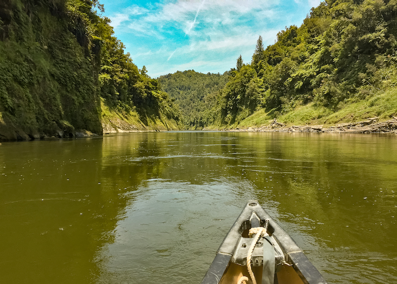
How far ahead should I book the Whanganui River section of the trail?
Due to the recommended start dates, most SOBO Te Araroa hikers will hit the Whanganui River section in late December or early January, which is the busiest time of year.
The Whanganui River is one of New Zealand’s 10 Great Walks and is very popular during the summer season. That being said, there are plenty of campsites and huts along the river. Canoe companies are very aware of TA hikers at this time of year and will do their best to accommodate you.
I was scheduled to hit the Whanganui River on Christmas Day, and my entire group managed to book their canoes as we passed through Taumarunui only a week before. I highly recommend Ron, Karen & their family at Taumarunui Canoe Hire – they live and breathe the Whanganui River and go out of their way to help TA hikers. Find out all you need to know about the Whanganui River section here.
How far ahead do I need to book transport around estuaries and rivers such as Marsden Point, and the Rakaia and Rangitata rivers?
On Te Araroa it always pays to be looking ahead a few days to see if there’s any accommodation or transport you need to organise. There are three water crossings on the North Island to be aware of: Puhoi River, Ngunguru Estuary and the Marsden Point crossing. Make sure to contact the shuttle/kayak operators 2-3 days before you’re due to hit them to make sure they have room for you so you can plan accordingly.
On the South Island, cellphone reception is very limited so you should be aware of your upcoming crossings before you head into the relevant section. For the two Hazard Zones at the Rakaia and Rangitata Rivers you’ll need to organise your transport around before you leave Arthurs Pass and/or Methven. You’ll also need to organise transport around Lake Wakatipu before you leave Queenstown.
Should I just hike the South Island?
Every year there are thru hikers who choose to hike just the South Island section of the trail. They often cite the high proportion of road walking on the North Island and the fact that the trail regularly passes through towns and cities. I think these hikers miss out on a key aspect of a Te Araroa thru hike, which is to experience good kiwi culture and hospitality.
Even as a New Zealander my eyes were opened to the generosity of good souls that live outside of our main centres, and I thoroughly enjoyed meeting all the different people along the way. The North Island is more of a cultural experience, whereas the South Island is more of a wilderness experience, and the beauty of Te Araroa is getting to enjoy these experiences side by side on one trail.
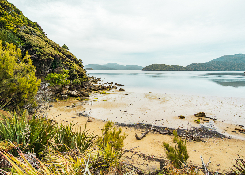
Is Rakiura / Stewart Island part of the trail?
The trail’s official southern terminus is in Bluff, however many thru hikers choose to continue their adventure by heading south to Rakiura and completing either the Rakiura Great Walk or the North West Circuit. This is a great way to extend your Te Araroa experience and finish your time in New Zealand… provided you survive the notorious ferry crossing from Bluff to Oban! Find out more about Rakiura here.
Can I bring my animal with me on Te Araroa?
Most of the access agreements with private landowners along the trail have been negotiated for walking only. Most private land is farmland so farm stock has to be protected. This means dogs and other animals are strictly prohibited. The remainder of the tracks are DOC tracks where dogs and other animals are usually restricted anyway. This leaves only urban sections, beaches and road walks suitable for animals.
How fit should I be to hike Te Araroa?
When I first set foot on Te Araroa I had almost no prior hiking experience. I’d only done one overnight trip and I wasn’t hitting the gym regularly. I wouldn’t necessarily recommend this as a strategy but it does show that it’s possible to hike Te Araroa with almost no prior training. That being said, it was a pretty painful month to start with!
Whilst prior training is certainly beneficial, in reality you’re going to build most of the fitness you’ll need on the trail. I’d suggest using the months before a thru hike walking regularly with a fully loaded pack for a couple of hours. If you have time, do a few long weekend trips and some hill climbs. But above all, just be kind to yourself and go slowly.
What’s the best way to navigate on Te Araroa?
The preferred method of navigating on Te Araroa is with the Te Araroa Trust’s paper maps and a compass. But unless you’re already skilled at map reading, these items will probably be useless to you. Much of Te Araroa is well-marked (check this video on Te Araroa navigation & trail markers for more info) but I’d highly recommend you download either (or both) The Trail App and FarOut Guides‘ (aka Guthook) Te Araroa Maps.
If you have a GPS device, you can download the Te Araroa map GPX files from the Trust website (use the link for paper maps above) and load them into your device. Just bear in mind, if you’re relying on electronics for navigation you should always ensure you have plenty of backup battery power to charge up in an emergency.
How do I get to/from the northern or southern trailhead?
Cape Reinga – Kaitaia is your main destination to get to via plane or bus. You can fly from Auckland direct to Kaitaia and Kerikeri. Otherwise you can catch an Intercity bus from Auckland to Kaitaia (stopping at Whangarei, Paihia and Kerikeri along the way). From Kaitaia you can then get a private shuttle, hitchhike or catch a tourist bus to the Cape. Check the trail notes for more info.
Bluff – Invercargill is your main destination via plane or bus. If you’re on the North Island you can get a direct flight to Invercargill from Auckland, or you may have to transit through Wellington or Christchurch. Once in Invercargill, you can pick up a local shuttle bus (such as the Stewart Island Experience Ferry Shuttle) or hitchhike to Bluff.
How do you pronounce Te Araroa?
Phoenetically, the phrase Te Araroa can be broken down into syllables and pronounced as follows:
Te as in “teh”
Ar as is “are”
a as in “ah”
ro as in “raw”
a as in “ah”
Te Araroa = Teh Are-ah-raw-ah
Where can I find the Te Araroa trail map?
The current year’s trail maps and trail notes can be downloaded directly from the Te Araroa Trust’s website, or can be downloaded for use online & offline on the TA App [ App Store | Google Play Store ].
I hope you’ve found these Te Araroa Frequently Asked Questions useful in planning your upcoming day, section or thru hike on New Zealand’s Te Araroa.
Do you have a frequently asked question about Te Araroa that you think should be featured in this article? Please get in touch with me so I can add it to this post.