
Long White Gypsy uses affiliate links and is a member of the Amazon Services LLC Associates Program. If you make a purchase using one of these links, I may receive a small commission at no extra cost to you. See my Privacy Policy for more information.
Have you seen Lord of the Rings and wished that you could visit the real life Mount Doom? Well, you can!
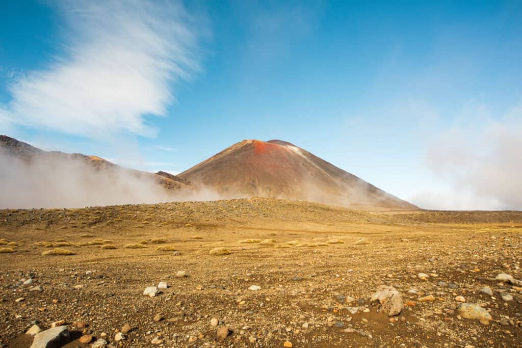
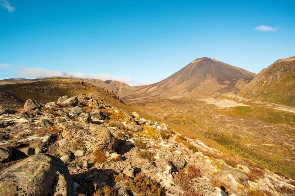
Mt Ngāuruhoe (pronounciation ‘naa-ooroo-hway‘) is located in New Zealand’s Tongariro National Park. This active volcano played an iconic role as Mordor’s Mount Doom in Peter Jackson’s film adaptation of J.R.R Tolkien’s classic fantasy novel The Lord Of The Rings trilogy.
I’ve lived less than an hour’s drive from Mt Ngāuruhoe for 20 years. I’ve hiked on and near this mountain multiple times and I’ve seen first hand exactly what can go wrong when visitors underestimate this hike.
So in this blog post you’ll find heaps of local advice about what you need to know before tackling this incredible mountain.

The climb up Mt Ngāuruhoe isn’t easy by any means. The height of Mount Doom NZ is 2,287 meters / 7,503 feet tall. But there’s a handful of people who still attempt the climb each year.
But make sure to read all the way to the bottom to find out why I (& other kiwi locals) respectfully ask that you don’t climb Mt Ngāuruhoe at all.
How To Climb New Zealand’s Mount Doom (Mt Ngāuruhoe).
In Lord of the Rings Mount Doom was the final destination where Frodo Baggins journeyed to destroy Sauron’s one ring. This has made Mt Ngāuruhoe an iconic destination for LOTR fans from all over the world looking to experience Middle Earth first-hand and feel a connection with these beloved fantasy novels.
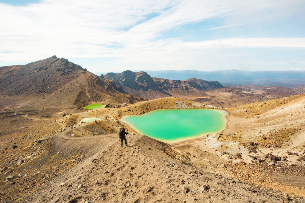
The climb to Mt Ngāuruhoe / Mount Doom is located on another very popular walking track, the Tongariro Alpine Crossing. Each year over 150,000 people flock to this location to tackle one of the world’s most popular day hikes, and to try their hand at climbing the mountain.
Many fail, a good handful get hurt and have to be rescued from the mountain, and almost every year someone dies on the mountain.
Three Things You Should Know Before Climbing Mt Ngāuruhoe
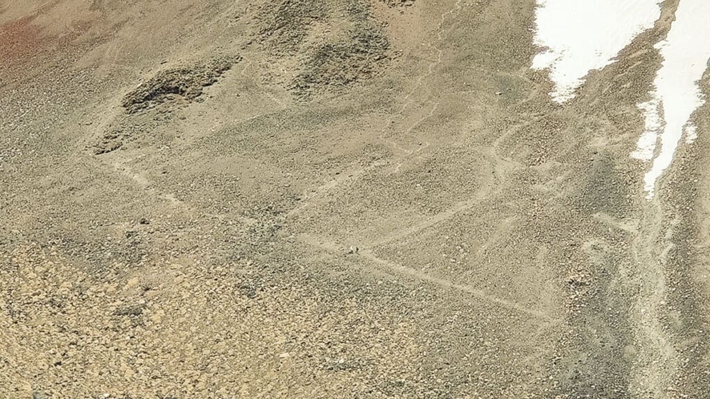
- Track markers were removed several years ago to discourage people from climbing the mountain, to protect it from the thousands of visitors that try to climb it each year, and also to respect local cultural values. You need to have skill at picking a route up a loose mountainside to attempt this track.
- Department of Conservation (DOC) rangers and representatives from the local Māori tribe often patrol the track near the top of the Devil’s Staircase to discourage people from climbing the mountain and ask them to respect cultural beliefs.
- Shuttle companies operate on concessions from DOC but many also have a protective attitude towards the mountain. They may refuse to transport you to the track if you indicate you want to climb it.
So here are some local tips (as someone who’s lived in the area for almost 20 years) for how to safely climb Mount Doom / Mt Ngāuruhoe.
Where is Mt Doom in New Zealand?
Located in the Tongariro National Park Mount Doom / Mt Ngāuruhoe sits in an active volcanic landscape that spreads across what is known as the Central Plateau region of New Zealand.
Contrary to popular opinion, this is not a standalone mountain. Mt Ngāuruhoe is a separate cone of Mt Tongariro, the larger volcano you will cross on your trek.
The mountain is usually accessed from the world-famous Tongariro Alpine Crossing day hike. Most people choose a route up Mt Ngāuruhoe which begins from the flat expanse of South Crater, approximately 1.5 to 2 hours into the hike.
The closest main centre to Mt Doom NZ is Taupō, but it’s common for visitors to stay at Whakapapa village, National Park village or Ohakune before attempting the Tongariro Alpine Crossing hike.
Here are some helpful distances/travel times from the main centres on the North Island:
- Ohakune – 54km / 45 min
- Taupō – 93km / 1hr20min
- Tauranga – 235km / 3hr15min
- Wellington – 342km / 4hr20min
- Auckland – 357km / 4hr15min
Is this the same Mount Doom from Lord of the Rings?
Have you been wondering whether this is the same Lord of the Rings volcano we see in the movies? Let me enlighten you.
Yes it is. But also, no it isn’t.
Many of the top-ranking blog posts about climbing Mount Doom are written by non-New Zealanders who know just as much about LOTR filming in New Zealand as you do.
As a NZ local who’s also a LOTR superfan, I can tell you that most of the LOTR filming locations in New Zealand (especially now, over thirty years later) are almost unrecognisable from the movies.
You have to know the movies inside and out to recognise anything at these locations (although of course they are still exceptionally beautiful places to visit!).
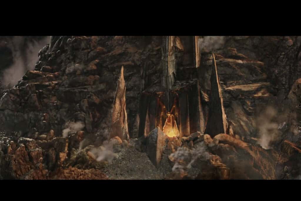
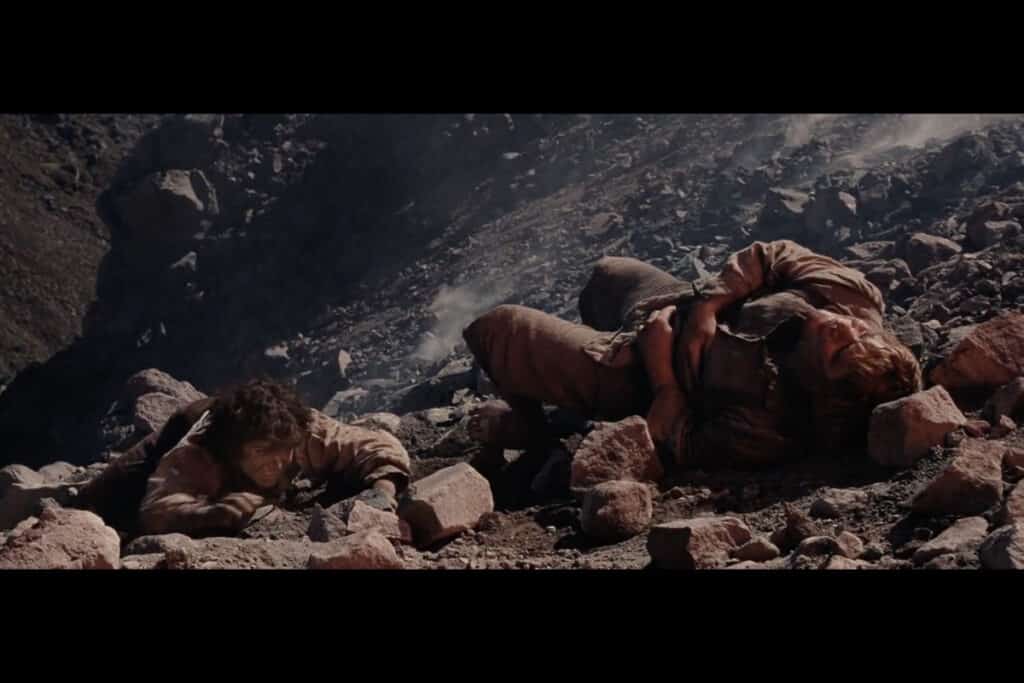
But like the other filming locations, Mt Ngāuruhoe barely resembles anything of the Mt Doom you saw in the movies. Only some of the close-up shots of Frodo and Sam were actually filmed on the mountain and in the surrounding area.

The long shots of Mount Doom (i.e. the majority of the footage you see of it) are computer generated. They’re not real.
In real life, Mt Ngāuruhoe does not look at all similar to the Mount Mordor we all know and love.
It’s not constantly spitting fire or lava (thank goodness). There aren’t any ledges leading to caves or tunnels where you can reach Mount Doom inside the mountain and throw the One Ring into the fires of Mordor.
In fact, please follow leave no trace principles and don’t litter on the mountain by tossing your replica One Ring into the crater of Mt Ngāuruhoe when you reach the summit.
It’s just a dry crater at the summit, and there’s nothing to see but loose rock and boulders on the way up.
🔥 HOT TIP 🔥
If you want a true LOTR experience, I highly recommend a trip to the Hobbiton Movie Set in Matamata instead. This is personally recommended by me, 110,000% worth it, and a must-do if you’re into LOTR tourism. Click here to check prices & availability.
How long does it take to hike Mount Doom?
If you’re still intent on hiking to the top of Mount Doom, you can expect it to take an additional 2 to 3 hours from the South Crater access point (approx. 1 hour into the trek) to ascend, and under an hour to descend.
This adds a substantial amount of time to your already lengthy Tongariro Alpine Crossing trek and you should be prepared to be on the mountain for at least 10 hours (but probably a lot more) in unforgiving conditions exposed to the harsh weather and lack of water.
You can shorten your trip by only climbing to the top of the Devil’s Staircase, climbing Mt Ngāuruhoe and then returning the same way. But as this will take you at least 5 hours to complete, you won’t be able to leave your car at the Mangatepopo carpark.
You’ll need someone to drop you off and pick you up from the Mangatepopo carpark, and not all shuttle companies offer this option.
The upshot is, that if you wish to hike Mt Doom NZ you need to:
– be incredibly fit;
– be used to hiking 10+ hours across rough & uneven terrain;
– have all the right gear for the harsh conditions; and
– be prepared to carry 4 to 6L of water with you over that terrain.
Is it difficult to hike Mount Doom New Zealand?
The Mount Doom hike is regarded as one of the hardest ‘trekking’ mountain routes for non-mountaineers, with probably only Mt Taranaki being harder.
This is due to the unique combination of the following:
Tephra / scree slopes: The sides of Mt Ngāuruhoe are made from deep, loose and unstable tephra (loose volcanic debris). It’s like walking for hours up a sand dune. For every step forward you’ll take two steps back.
Exposure: There’s no shade or shelter on Mt Ngāuruhoe at all. Plus you’re heaps closer to the ozone hole. Sunburn and sunstroke, as well as hypothermia, are real risks.
Lack of Water: There’s no drinkable water anywhere on this trek. Lakes and streams along the way contain heavy volcanic metals making them unsafe, plus they’re tapu (sacred) and it’s disrespectful to touch them.
Falling Rocks: There’s no signposted path up the mountain. Most climbers make it up as they go. With people all over the place, you’re at real risk of being hit in the head by falling rocks & boulders dislodged from above (this happens a lot & it’s the most common cause of injury).
Active Volcano: Ngāuruhoe may not have erupted since 1975, but it’s still an active volcano. You’re walking right into the dragon’s maw by summiting the mountain (but I suppose the entire Tongariro National Park carries this risk).
Distance: Due to parking restrictions at either end of the track, to attempt the climb you’ll also need to complete the entire Tongariro Alpine Crossing (19.4km) trek. As the crow flies the side-track to the Mount Doom summit is an extra 1.3 km. But your route up the mountain will be longer because you’ll zig-zag some of it. This brings your total distance for the day to around 25km and even the fittest hikers will take at least 10 hours to finish (average hikers could take 12+ hours).
How tall is Mount Doom?
Mount Doom New Zealand is 2,287 m / 7503 ft tall. But it’s important to remember that this Mount Doom height is calculated from sea level: you won’t actually climb this distance to the summit!
But this Mount Doom walk is certainly not for the faint of heart. There’s still a substantial amount of climbing on this route.
You’ll begin your ascent of Mt Ngauruhoe from 1,100m / 3,600ft at the Mangatepopo carpark, and first climb 500 vertical metres (1,600ft) to the top of the Devil’s Staircase. Here you’ll be at the start of the Mount Doom climb at South Crater. There’s still another 600 vertical metres (1,968 feet) to the summit!
How To Get To Mount Doom.
For those looking to take on the challenge of climbing Mount Doom New Zealand, there are a few ways to get there including private or rental car, shuttle transport from the Ketetahi road-end and complete drop-off / pick up services from nearby centres.
Private Car / Rental Car (Self-Drive)
A private car or rental car is the best option for getting to Mt Ngāuruhoe due to its convenience, flexibility, and cost-effectiveness.
Because you’re walking back to your own car and don’t need to rush to reach a return shuttle at the other end you’ll have plenty of time to finish your walk.
The private car is by far the cheapest option, but you can get yourself there by rental car.
Rental Car Hire from Auckland
The cheapest and most economical way to get a rental car is to hire it from your port of entry into New Zealand (most likely Auckland). A 4-week rental car hire from Auckland Airport (peak season) starts from about $1,500 ($50/day) and can go up to $3 – $4k+ ($150+/day).
Rental Car Hire from Taupō
If you only need a rental car hire to get to/from the Tongariro Alpine Crossing for the day, you can get a 2-day rental car hire from Taupō for about $160/day. There are far fewer rental car options in Taupō so I recommend you book well in advance to avoid disappointment.
To get to the start of the track, you need to drive to the Tongariro Crossing Carpark on State Highway 46 where you can either park on the side of the highway and catch a pre-booked shuttle, or use the secure car park shuttle service.
Tongariro Alpine Crossing Carpark Shuttle
This is because there’s a 4-hour parking limit at both ends (Mangatepopo and Ketetahi) of the Tongariro Alpine Crossing track. The parking limits are heavily enforced by wardens, and your car may be clamped if you go over the limit.
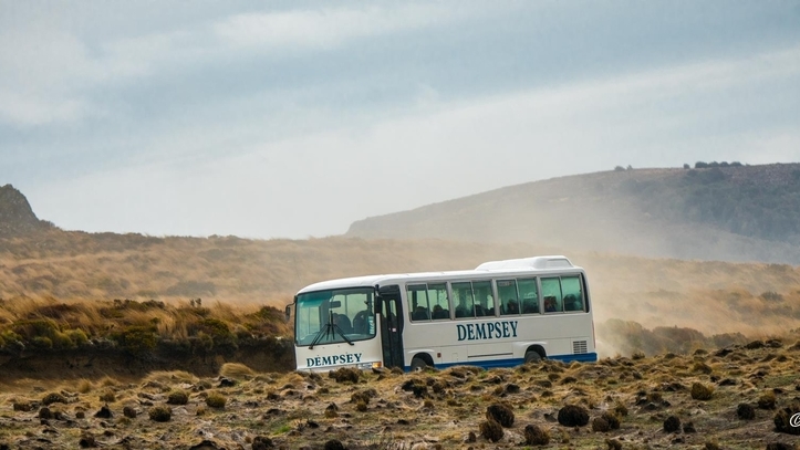
The shuttles work by having you self-drive to the Ketetahi end of the track and then they drive you to the start of the track at Mangatepopo. The ride takes about 20 minutes and is usually around $50 per person.
There are plenty of different companies to choose from. Take a look at my complete guide to the Best Tongariro Alpine Crossing Shuttles for more info.
TRAVELING TO THE TONGARIRO ALPINE CROSSING?
Check out my recommendations for the Best Tongariro Alpine Crossing Shuttles to make your trip a breeze!
⭐ MY TOP PICK ⭐
Tongariro Crossing Mountain Shuttle
My recommendation is the Tongariro Crossing Mountain Shuttle (an iwi-operated company) which gives you access to the secure car park just off SH46 (otherwise you have to park less securely on the side of the state highway).
Just check what time they close the car park gates!
Round Trip Drop-off / Pick-up Shuttles
The final option for transport to the Tongariro Alpine Crossing (and Mt Ngāuruhoe) is a round trip pick up & drop off option.
This type of service will collect you from your nearby accommodation (i.e. Whakapapa, National Park, Ohakune, Taupō etc.) and bring you to the start of the track. They will then organise a pre-arranged time to pick you up from Ketetahi at the end of your trek.
The cost varies depending on where you’re being picked up from (again, check my complete guide to the Best Tongariro Alpine Crossing Shuttles for more) but the closer you are to the track the cheaper it will be.
The downside of using this option is that you may be cutting it very close. You’ll have to look for a shuttle company that drops off at the track first thing in the morning (around 7AM) and aim to catch the last shuttle back (5PM). But this only gives you 10 hours to complete the trek.
⚠️ IMPORTANT NOTE ABOUT BOOKING THE TONGARIRO CROSSING ⚠️
For the first time, a booking system was introduced for this track in July 2023. Hikers are now advised to make a booking before walking the Crossing (NOTE: bookings are required if you are taking a shuttle or guided walk). Whilst there is currently no cost for booking, or a daily cap on walker numbers, it’s possible this might be introduced from late 2024 onwards. Click here to find out more and make a booking.
Tongariro Alpine Crossing: Information For Hiking NZ
As mentioned above, if you want to climb Mt Ngāuruhoe, you also have to walk the Tongariro Alpine Crossing track. This is one of the world’s most popular day hikes, attracting hundreds of thousands of visitors each year.
READY TO TACKLE THE TONGARIRO CROSSING?
Find out what to expect and everything you need to know in my Local Guide to Hiking the Tongariro Alpine Crossing.
How far is the Tongariro Alpine Crossing?
The Tongariro Alpine Crossing is a 19.4 km / 12 mi alpine hike across an active volcanic landscape traversing up and over the large volcanic peak, Mount Tongariro.
The official start of the track is at Mangatepopo car park, and the track ends (after traversing in a generally easterly then northerly direction) at Ketetahi car park on the northern side of Mount Tongariro.
The track can be walked in either direction, but it is much easier and more popular to walk from Mangetepopo to Ketetahi because of easier shuttle transfer options and less elevation gain.
Tongariro Alpine Crossing Difficulty
Don’t let the hoards of people (150,000 or more each year!) fool you – this is a challenging hike across dangerous and rugged terrain. The full hike can take anywhere from 5 to 10+ hours depending on your speed, ability and preparedness.
The track has steep ascents, descents, and uneven terrain which can be treacherous. There’s lots of loose, sharp and uneven volcanic rock underfoot, a set of steep stairs to climb at the head of the Mangetepopo Valley (about an hour into the trek), a steep scree slope to descend and plenty of elevation gain/loss.
In good weather, the track is achievable by most people who are well-prepared with proper gear and plenty of snacks and water.
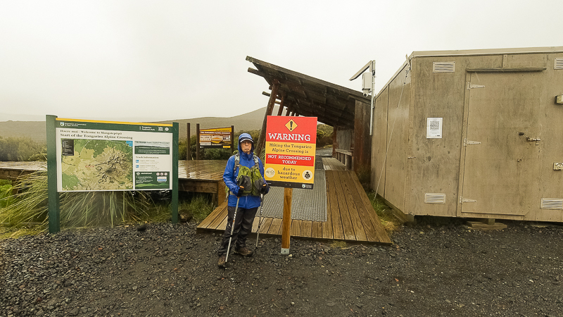
In bad weather, this track becomes treacherous and you should not attempt it unless you have the right gear and equipment. Torrential rain, gale-force wind and snow are all possible, even in the height of summer. Check the weather forecast for the Tongariro Alpine Crossing before you go.
The Department of Conservation will put up signs at the start and end of the track advising it’s not safe if weather conditions are too bad.
Can you trek the Tongariro Crossing and Mount Doom?
It is technically possible to hike the Tongariro Alpine Crossing track and climb Mount Doom, but this should only be attempted by the fittest and most experienced hikers due to the extra time and distance a summit attempt adds (even fit hikers will probably take 10+ hours to complete).
Important Note: Tongariro Alpine Crossing Bookings
In October 2023 a booking system was introduced for the Tongariro Alpine Crossing to monitor visitor numbers. It is now recommended that all Tongariro Crossing hikers make a booking via the online system before embarking on their walk.
Because Mt Ngauruhoe is located on the Tongariro Alpine Crossing, you will also need to make a booking to climb it.
Bookings are easy to make, and at the moment are free. Find out more about Tongariro Crossing Bookings here.
What Should You Pack For Your Mt Doom Hike?
If you want to tackle the climb to Mount Doom in NZ’s very own Mordor, you need to be well prepared for any eventuality.
Here’s a comprehensive list of gear to pack for this trek.
Must-Have Items
- Day pack – at least 20-30L so you have plenty of room for all the gear you need to carry. I recommend the Osprey Daylite Plus or Stratos.
- Pack liner – a plastic bin liner will suffice in a pinch, but I recommend the MSC pack liner which also doubles as an emergency bag.
- Water (at least 4-6L per person) – I recommend a 3L water bladder plus some bottles.
- Lunch & plenty of high-energy snacks
- Phone / camera
- Backup battery power for phone – I recommend something like this Anker 10,000 maH portable charger
- Toilet paper / tissues
- Rubbish bag
- Sunglasses, hat, sunscreen (50+ UPF)
- Gloves, beanie, scarf (regardless of weather)
Emergency Items
- Small first aid kit – I recommend this kit designed specifically for NZ tramping
- Torch / headlamp – I recommend this headlamp which is lightweight but also very bright.
- Personal Locator Beacon – This is my personal choice.
- Firestarter / matches
- Emergency shelter – A lightweight tent is preferable, but if you don’t have room an emergency foil blanket is an absolute minimum.
Clothing
- Short-sleeved hiking top
- Long-sleeved hiking top – I love this Columbia sun shirt.
- Shorts / trousers
- Merino or polypropylene base layers – My personal fav are the Macpac merino base layers.
- Underwear
- 2x pairs of hiking socks
- Fleece (or other mid layer)
- Insulated jacket – These down jackets are my choice.
- Waterproof rain jacket – Such as this lightweight but highly waterproof one.
- Waterproof rain pants/skirt – Look for high waterproofing but breathable like these.
- Sun hat – The bigger the brim the better for this climb!
- Hiking boots – Due to the scree slope I recommend a sturdy boot for this Mt Doom hike, something like these Keen Targhee mid-rise boots.
Optional Items
- Trekking poles (optional) – I love these ones which will give added support on the way down the mountain.
- Lip balm
- Umbrella (optional) – For shade rather than rain protection. I recommend this one.
Where To Stay When Visiting Mount Doom.
Those wanting to get their Mt Doom Lord of the Rings fix have plenty of options for accommodation nearby. The closest are the holiday parks located at Whakapapa Village and on State Highway 47 (just 5 mins drive from Ketetahi). Further down SH47 is National Park village, where you can find a variety of accommodation options such as hostels, motels and ski lodges.
If you’re looking for a bigger town to stay in, Ohakune is only 45 minutes away to the south and has plenty of chalet-style options, whereas further north Taupō is a great place to base yourself from with budget to luxury accommodation options, shops and supermarkets.
✔️Best Budget Mount Doom Accommodation – YHA National Park
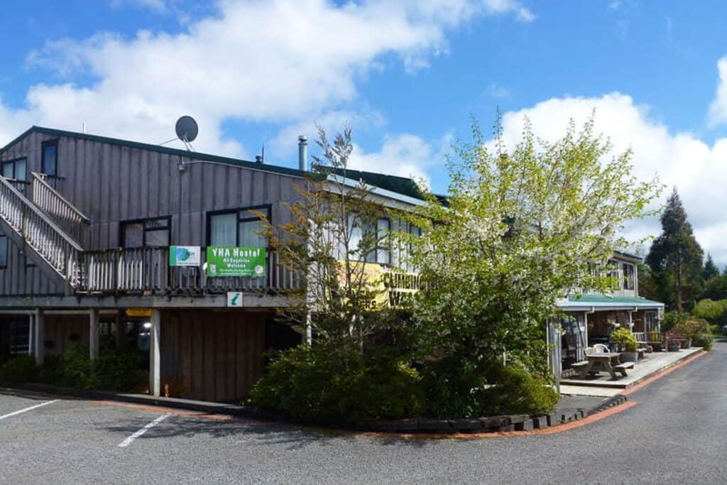
⭐️ Rating: 8 out of 10 stars | 📍 Location: National Park Village | Cost: $28 per night (bunk) / $70 per night (private room)
The National Park YHA is not only a great budget-friendly option for those looking to explore Mt Doom NZ, but is also a fantastic adventure base with its own indoor climbing wall! Only a 15-minute drive from the Tongariro Alpine Crossing, shuttle buses are available daily (weather permitting) for $50 per person.
The knowledgeable local staff will be more than happy to help you plan your trip. Features shared bathroom and cooking facilities, TV lounge, and you can purchase wifi vouchers for internet access. Dorm rooms are available from $28/night per person, or for more privacy book a private room from $70/night.
More Budget Mount Doom Accommodation
Plateau Lodge: 📍 Location: National Park | Cost: $110 per night (double room with shared bathroom) | ⭐️ Rating: 8.5 out of 10 (View on Booking.com)
Tongariro Holiday Park: 📍 Location: SH47, National Park | Cost: $30 per night (powered/unpowered sites) / $70 (double room, no linen) | (View on website)
National Park Alpine Lodge: 📍 Location: National Park | Cost: $60 per night (budget single room) | ⭐️ Rating: 8.1 out of 10 (View on Booking.com)
Whakapapa Holiday Park: 📍 Location: Whakapapa Village | Cost: ~$20 per night (powered/unpowered sites) / $76 (standard cabin 4 beds) | (View on website)
✔️Best Mid-Range Mount Doom Accommodation – Skotel Alpine Resort
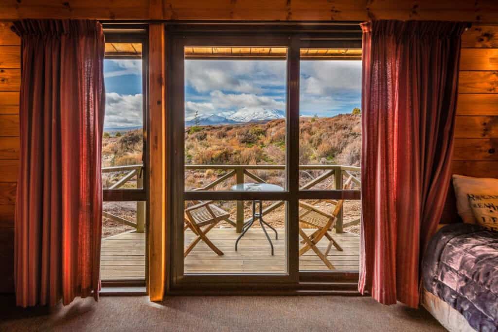
With exceptional views of Mts Ruapehu, Ngāuruhoe and the park landscape, the Skotel Alpine Resort is a classic landmark at Whakapapa. Offering its own restaurant, hot tub and a terrace bar with a fireplace, it’s just a stone’s throw from the ski slopes of Mt Ruapehu, and only a 5-10 minute drive to the Tongariro Alpine Crossing.
With shuttle transport right from the doorstep, yet the comfort and luxury of a quintessential ski resort, this is a don’t-miss opportunity to spend a magical night in the heart of the North Island’s most popular national park. I recommend the queen room (with its own ensuite) for an affordable middle-of-the-road option or upgrade to a Ngāuruhoe room to bring those views straight to your bedside.
More Mid-Range Mount Doom Accommodation
Ranfurly Cottage: 📍 Location: Raetihi | Cost: $186 per night (double room with private bathroom) | ⭐️ Rating: 9.5 out of 10 (View on Booking.com)
Rocky Mountain Chalets: 📍 Location: Ohakune | Cost: $237 per night (one bedroom chalet) | ⭐️ Rating: 8.9 out of 10 (View on Booking.com)
Mountain Heights Lodge: 📍 Location: National Park | Cost: $165 per night (family room with bathroom) | ⭐️ Rating: 8.7 out of 10 (View on Booking.com)
Tongariro Holiday Park: 📍 Location: SH47, National Park | Cost: $180 per night (queen studio) | (View on website)
✔️ Best Luxury Mount Doom Accommodation – Night Sky Cottage

⭐️ Rating: 9.5 out of 10 stars | 📍 Location: Horopito Ohakune | Cost: $815 per night (chalet)
The Night Sky Cottage in Ohakune offers an unparalleled luxury experience for visitors to Mount Doom. Set among protected New Zealand native manuka and beech bushland, you’ll have full access to explore the best of the Central Plateau’s wilderness whilst still within a 30 minute drive of the Tongariro Alpine Crossing.
The well-appointed two bedroom chalet is big enough to house large groups, but also provides space and a romantic atmosphere for couples, with side by side bathtubs overlooking the bush. Free wifi and breakfast on request also available.
More Luxury Mount Doom Accommodation
Tongariro Suites: 📍 Location: Ohakune | Cost: $425 per night (suite with mountain view) | ⭐️ Rating: 9.5 out of 10 (View on Booking.com)
Ruapehu Country Lodge: 📍 Location: Ohakune | Cost: $276 per night (king room with private bathroom) | ⭐️ Rating: 9.6 out of 10 (View on Booking.com)
Why You Actually Shouldn’t Climb Mt Ngāuruhoe.
Climbing Mt Ngāuruhoe is high on the to-do list for Lord of the Rings and adventure travellers, but as a local who’s carefully watched the transition the entire Tongariro National Park has gone through in the two decades since the release of the Lord of the Rings films, I’d like to respectfully ask you to reconsider your plan to climb this iconic mountain.
To understand why I’m asking this, you need to understand the change in tourism in this region since the films’ release. Annually, there are now well over 150,000 visitors to the Tongariro Alpine Crossing each year. Remember this is a ‘wilderness’ area with a fragile ecological and geological environment.
Frodo Climbing Mount Doom GIF. You’re welcome.
Environmental
There are many species of lichens, mosses, alpine flowers and more that only grow in the Tongariro National Park. Throughout the park, you’re generally asked to stick to the marked tracks where possible, to avoid trampling and damaging this fragile environment.
During its heyday (early 2000s to mid-2010s) it was common to see a ‘line of ants’ climbing up Mt Ngāuruhoe on any given day during the summer season. Not only was this dangerous, but it also had a huge erosion effect on the mountain.
With its popularity came more injuries (and even deaths) on the mountain, putting greater strain on rescue resources in an already challenging environment.
And unfortunately not all visitors follow leave no trace principles, meaning that there’s now more rubbish and human waste on the mountain than ever before.
Cultural
But it’s the cultural values that have risen to the forefront since 2017 when summit route track markers and signage were removed. The local iwi, Ngāti Hikairo ki Tongariro / Ngāti Tūwharetoa, take their role as kaitiaki (guardians) of Mt Tongariro and his peaks very seriously, not just for cultural reasons but also for visitor safety.
Whenever there is a death on the mountain, or anywhere in the Tongariro National Park, a rāhui (temporary prohibition) is placed on the nearby area. This can result in mountains and tracks being closed for days or even weeks.
Most mountains in New Zealand are regarded as tapu (sacred) and it’s considered highly disrespectful to stand atop their peaks. It was at Ngāti Hikairo ki Tongariro’s request that the Department of Conservation finally removed track signage in October 2017.
The Department of Conservation defers to local iwi for guidance on how best to manage and protect these mountains. In turn, DOC issues the concessions (effectively permits) to shuttle and tour companies to operate their businesses to, from and on these mountains. These companies have a contractual obligation to dissuade people from summiting the mountains where possible.
Think Twice
For these reasons, I’d ask you to seriously consider the ethical and environmental implications of climbing Mt Ngāuruhoe before doing so. Check out the “Three Things You Need to Know Before Climbing Mt Ngāuruhoe” at the top of this post for more on what you may have to deal with along the way.
If you decide to go ahead with your climb regardless, please make sure that you take all necessary safety precautions and respect the local culture and environment by following Leave No Trace principles. Doing this will help ensure that future generations will be able to enjoy the unique beauty of this special place.
What is Mount Doom really called?
The mountain used to film Mount Doom (the volcano in Lord of the Rings) is actually called Mt Ngauruhoe (‘naa-oo-roo-hway’). It’s located in the Tongariro National Park in New Zealand, a dual UNESCO world heritage site.
Where is Mordor in real life?
The filming locations for the Mordor scenes in the popular Lord of the Rings movies (and the Mount Doom real location) were in the Tongariro National Park, New Zealand. Although only a few specific locations were used for filming, the entire Park has a distinctly ‘Mordor’ feel to it due to its active volcanism.
Are you allowed to climb Mt Ngauruhoe?
No one can stop you from climbing Mt Ngauruhoe because it’s located on public conservation land and everyone has access to it. However, local Maori tribes consider the summit to be sacred, and ask that you don’t climb Mt Ngauruhoe as a mark of respect for their cultural beliefs. It also helps prevent degradation of the mountain due to overtourism.
Conclusion: How To Climb New Zealand’s Mount Doom (Mt Ngāuruhoe).
Climbing Mt Ngāuruhoe is a popular bucket-list activity for Lord of the Rings and adventure travellers to New Zealand, but it’s important to consider the environmental and cultural implications before doing so.
For these reasons I respectfully discourage you from attempting to climb Mt Ngāuruhoe unless you’re already an experienced climber, take all necessary safety precautions and follow Leave No Trace principles out of respect for both the environmental and cultural values.
Even though you may be tempted by the prospect of summiting Mount Doom, remember that there are many other ways to enjoy this beautiful LOTR filming location and dual UNESCO world heritage status without causing any damage or disrespect.