
Long White Gypsy uses affiliate links and is a member of the Amazon Services LLC Associates Program. If you make a purchase using one of these links, I may receive a small commission at no extra cost to you. See my Privacy Policy for more information.
Although we hadn’t spoken the night before, Julia and I still awoke at our usual early hour the next morning. The climb over Mt Hakarimata faced us today: a daunting one. It was a gruelling 374 metres of incline over 12 kilometres with an estimated 6 to 7 hour timeframe to complete the entire track.
And we had 5 kilometres to walk before we even got there.
The visitor’s book I’d read the night before mentioned more than one occasion of hikers opting to use the bus route which runs between Huntly and Ngāruawāhia to craft an easier day for themselves. For the small charge of just $3.60 per person, we could catch a bus to Ngāruawāhia further down the trail, and walk back to Huntly (or vice versa). This effectively allowed us to walk without packs, or to slack pack.
I had a sneaking suspicion what Julia’s thoughts would be about this. But to my surprise, when I raised the idea with her she seemed to like it. It would mean a much more leisurely day for the both of us, and possibly even a more enjoyable one. And as a bonus, I was particularly taken with the lovely campsite at Huntly, with its large kitchen and brilliant amenities block. It wouldn’t be the end of the world to spend another night here.
It was decided, and we set off for the beginning of the track just before 8AM. Reconnecting to where we had left the trail the day before, it wasn’t long before we were back into the swing of things. We met an older lady outside her house a little further down the trail. She stopped us to ask about our packs, especially as she had seen lots of hikers walking past lately. We explained to her about the trail, and ended up in a long discussion with her which was difficult to get away from.
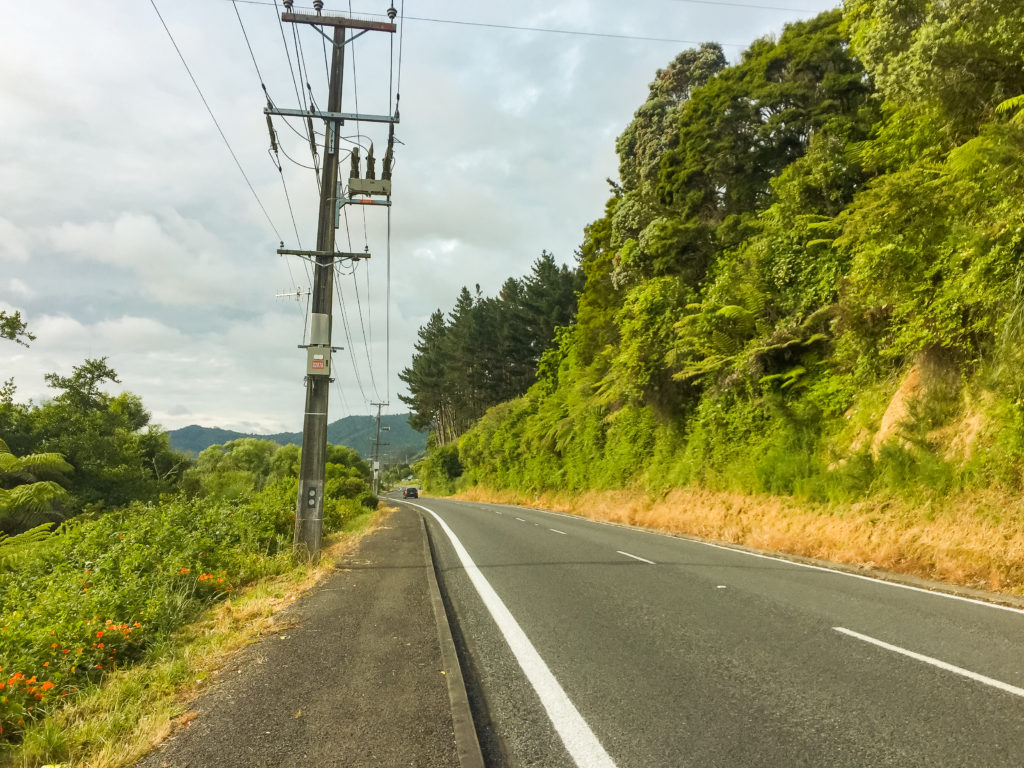 Hiking along a welcome pathway on Riverview Road just south of Huntly on our way to the Hakarimata Walkway.
I needed to pee very badly. But there was nowhere to stop along the road, and the traffic made it difficult to make a quick stop. Julia was desperate now, too. Eventually we found a place in the bushes that was sheltered enough from the road, so we made a quick dash for it.
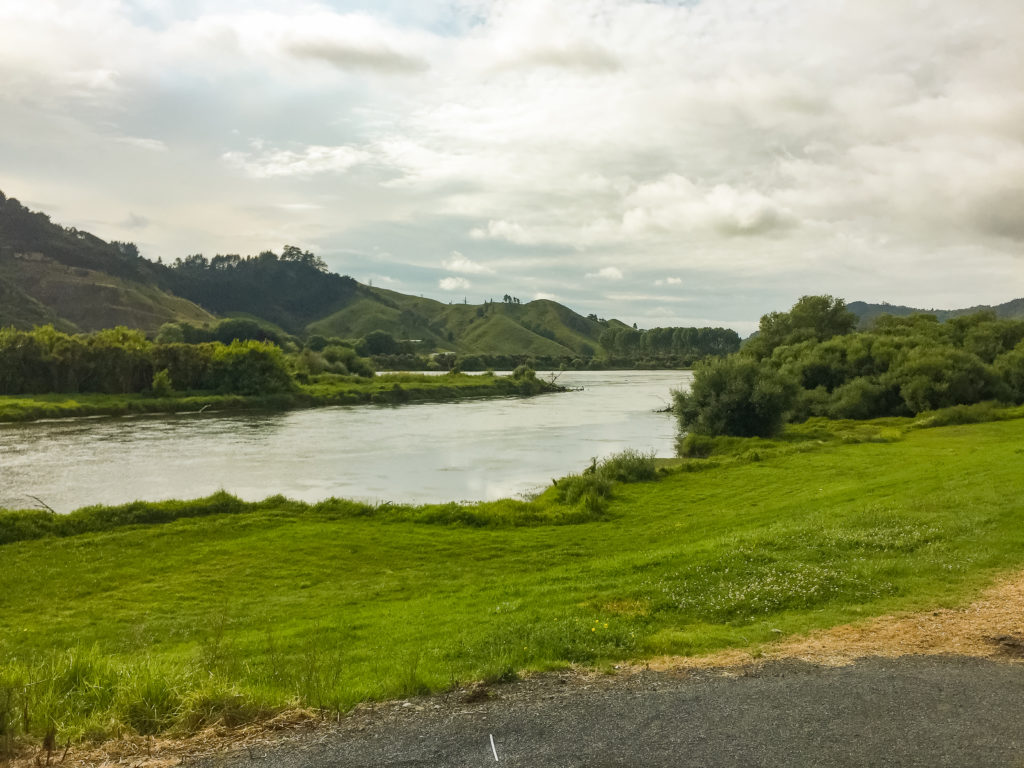 Walking peacefully alongside the south Huntly banks of the Waikato River, the old State Highway 1 route winding its way on the opposite bank.
The road walk to the Hakarimata track was a flat, easy and gradual one, although we did have to climb up a rural gravelled road for the last kilometre or so.
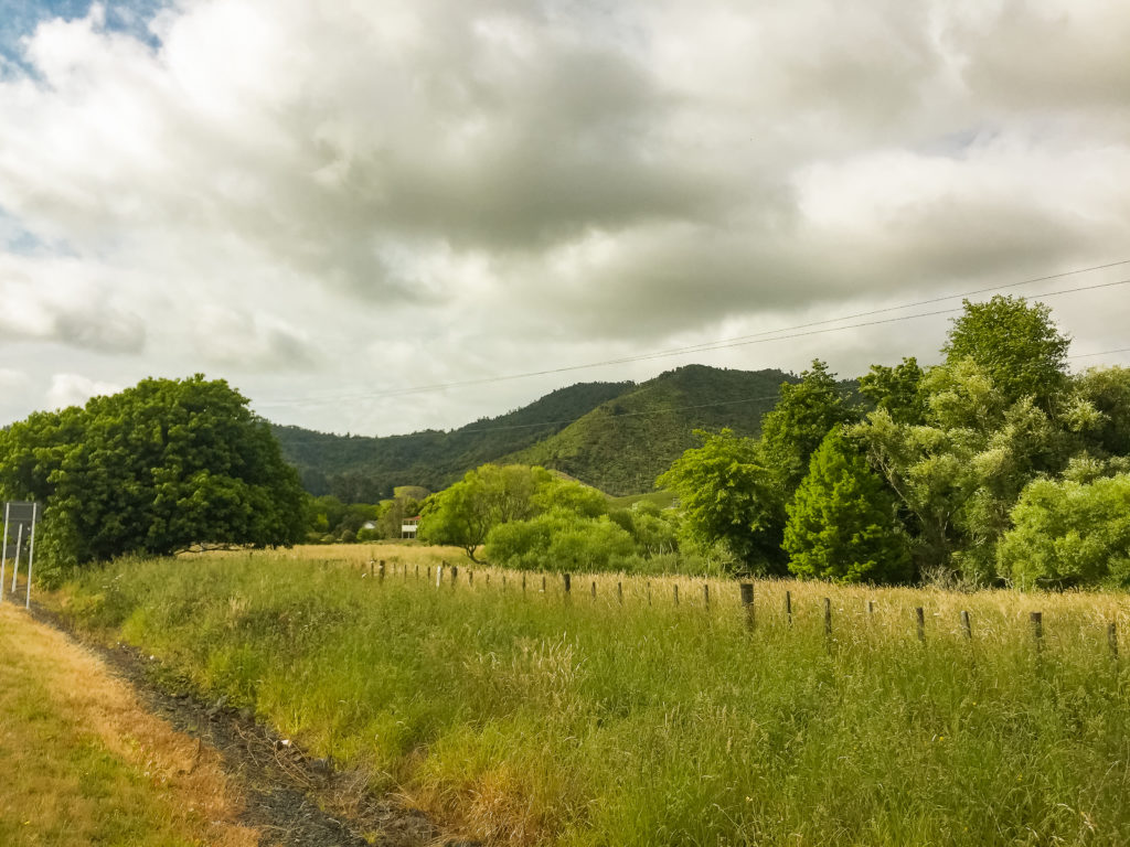 Catching our first real glimpse of the towering 374m mass of Mt Hakarimata on the road walk from Huntly.
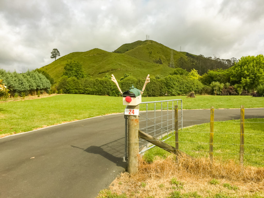 Another novelty letterbox photo to add to the collection, this one a Christmas themed reindeer for the upcoming holiday season.
Once at the trailhead carpark, the famous Hakarimata steps started. They were steep, but quite manageable without the weight of our full packs. I was puffing and panting within a few minutes, so Julia steamed on ahead of me very early on. It was also immediately much more humid. At one point I decided I needed to strip off down to just my sports bra, to try and get some air flowing over my skin.
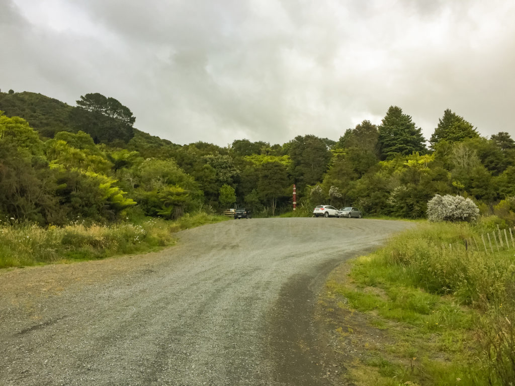 Arriving at the Hakarimata Walkway trailhead on Parker Road, about 5 kilometres south of Huntly township.
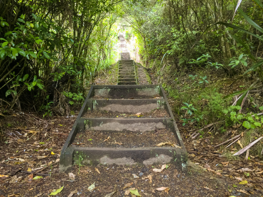 The beginning of the steep climb up the infamous staircase on the Hakarimata Walkway. We started counting each stair, but we’d already forgotten by the time we reached the top of this short section.
I passed a couple of viewpoints along the way, but I was determined to push on without a substantial break at least until I reached the ‘Upper Lookout’. It was only an hour into the climb, and not much further away now.
 A stunning viewpoint opens up through the dense bush in the climb up the first staircase on the Hakarimata Walkway.
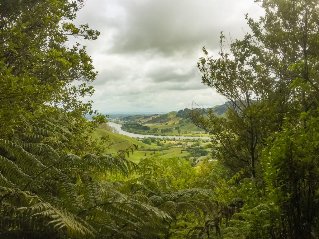 Taking a peek through a hole in the bush cover back down to the Waikato River.
When I arrived, Julia was there catching her breath. The views really were amazing, and we spent a long time looking out down the bright ribbon of the Waikato River, trying to map out the steps we had taken over the previous few days.
Being up at high elevations makes me appreciate the entire journey, and I enjoyed being here looking down on where I had come from this morning, even if only for the briefest of moments.
 Taking a well-earned breather at the lower lookout with sweeping views down to the snaking Waikato River below, almost all the way to our stop at Rangiriri the day before.
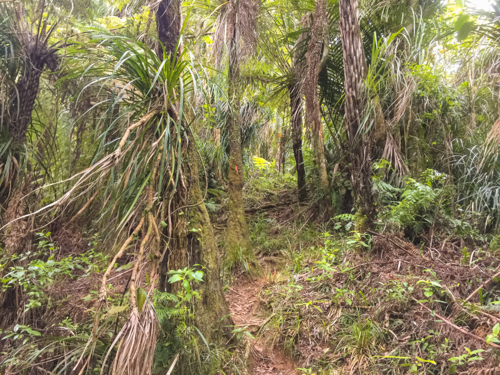
We pushed on to the Southern Lookout on a gruelling climb through a dense and rooty forest.
 The final short section of steep climbing to the Upper Lookout is punctuated by short sharp climbs and overgrown sections.
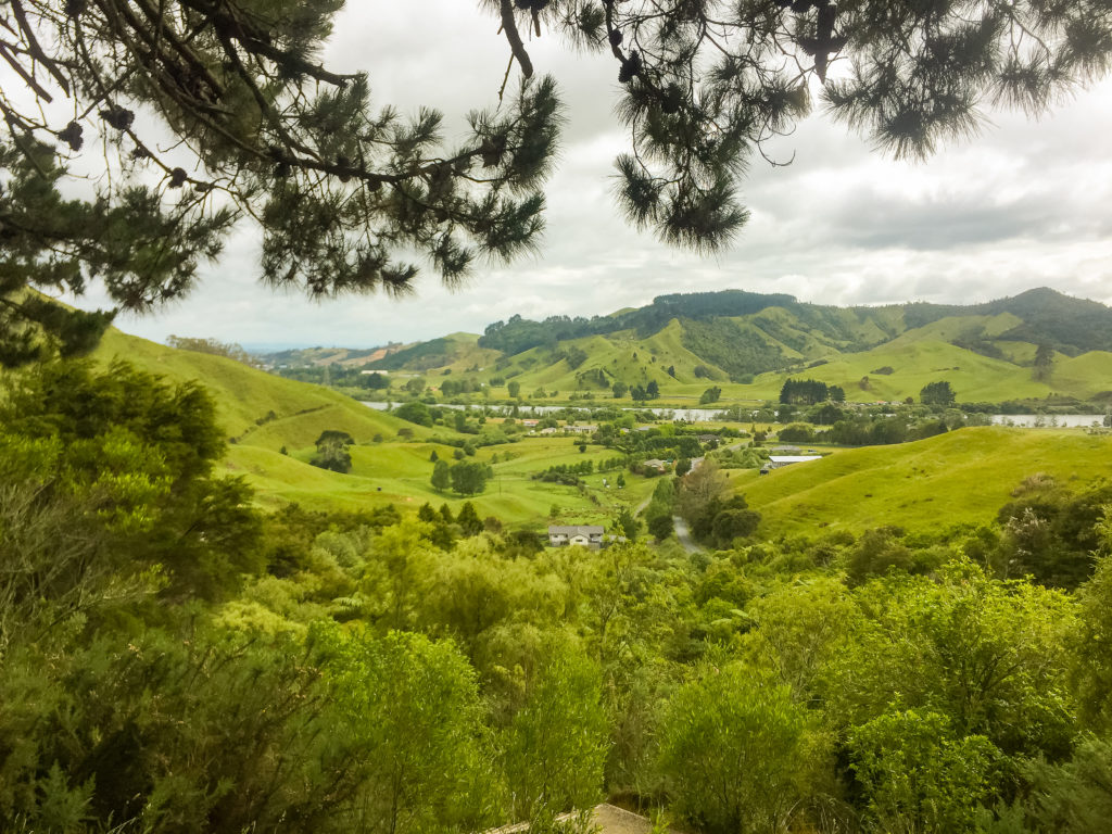
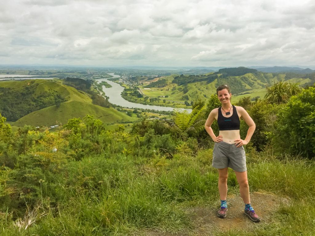
From the lookout point I desperately searched for any sign of the Central North Island region that I know and love. I wondered if I’d be able to see either the mountains of the Tongariro National Park or at the very least Mt Tauhara which sits on the shores of Lake Taupo. Unfortunately, it wasn’t to be. But we sat and stared at the expanse of Hamilton stretching out before us as we ate our morning tea and enjoyed the slightly cooler air which whipped through the trees.
 The view from the Upper Lookout towards the South, and the direction we will continue heading tomorrow.
Now that we had reached the main ridgeline of the Hakarimata walkway, it was a straightforward walk to the Hakarimata summit. There was a little bit of climbing (there always seems to be, even when we expect to be descending) but for the most part it was manageable and I found that I was quite enjoying myself. I appreciated the beauty of the surrounding forest, and I was thankful that I’d had the luxury of leaving most of my gear at the campsite this morning.
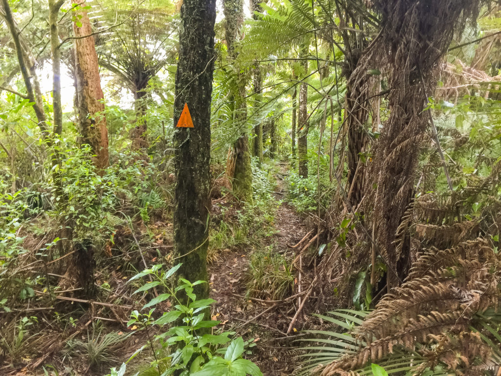 Trail markers are (thankfully) close together and well visible on the way through the Hakarimata mountain trail, making navigation a breeze.
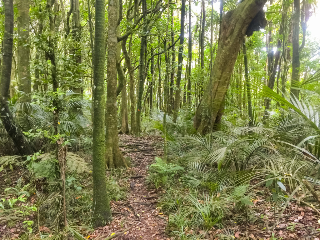 A slightly more manicured section of the ridge walk on Hakarimata mountain.
A little way along the trail we met two Hungarians who had wild camped on the forest trail the previous night. Their English wasn’t very good, so we didn’t strike up a very detailed conversation, but I watched them climb the same hills as we did with their full packs and felt incredibly sorry for them.
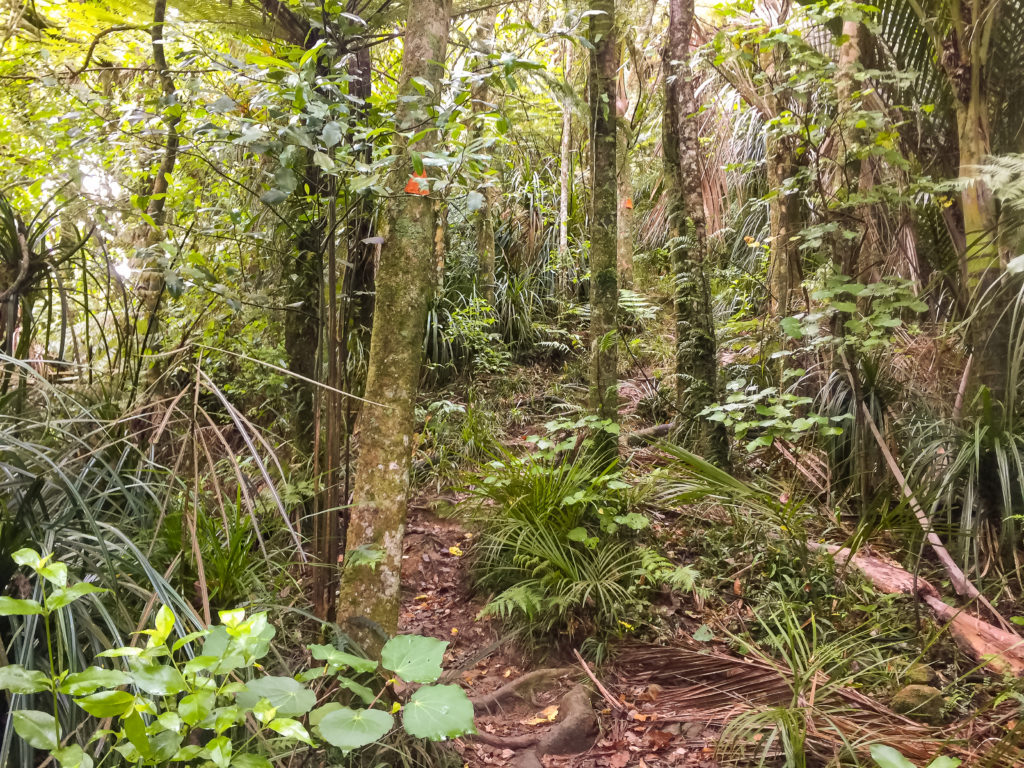
 It’s a strenuous hike up the mountain on narrow overgrown tracks such as this, with only the bright orange markers lending clues as to the way forward.
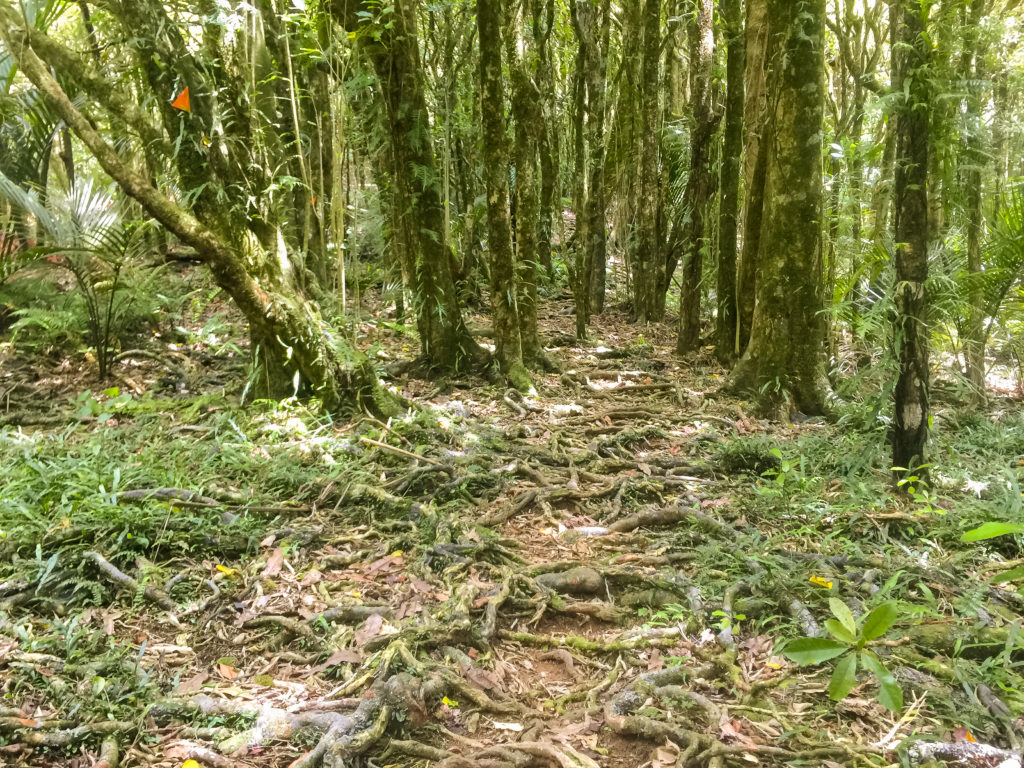 The track on Mt Hakarimata is dominated by rooty growth underfoot, as illustrated here in this photo.
A couple of hours later, we had reached the summit of the mountain. There was a wooden tower with a set of steps, from which we could gain 360 degree panoramic views of the surrounding countryside. It was spectacular. I stood for a long time admiring the view and congratulating myself again for how far I had come.
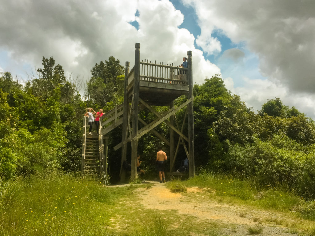 A small wooden platform stands proudly on the Mt Hakarimata Summit.
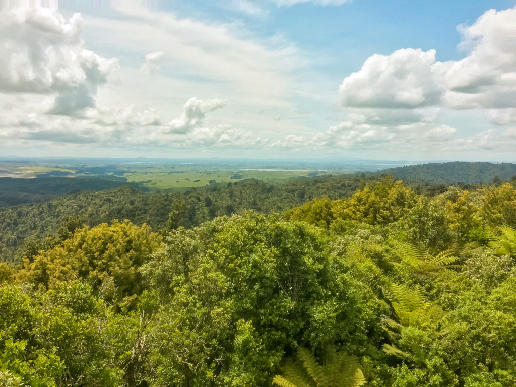 The view from the summit back North, from whence we have come.
It also gave me an opportunity to reflect on what the next few days would hold for me. I’d decided to hike into Hamilton tomorrow, where I would catch a bus back home to Taupō for a couple of days. Although my heat rash was doing better, my mind had been substantially weakened in the past few days. I was conscious of the negativity that pervaded each day, and wanted to try and right it as much as possible… if not just for myself than for Julia.
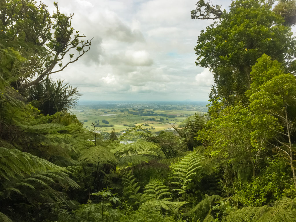
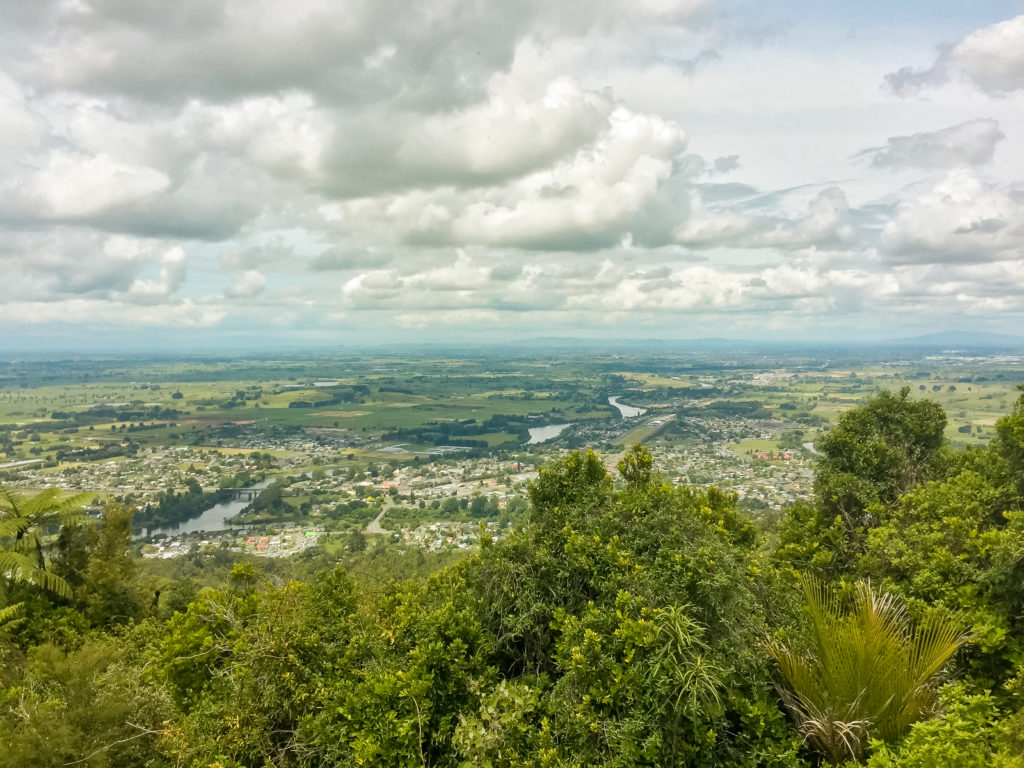 Looking out to the South along the ribbon of the Waikato river (as it runs into Hamilton) and towards south Waikato.
This knowledge that I wouldn’t be hiking for a couple of days, was enough to allow me a slightly different perspective on where I had come from, and how far I still had left to go. It still felt possible. And more importantly, I still felt that I wanted to continue on. I wasn’t worried by the prospect of going home, at least not as much as Julia seemed to be. I knew I had enough determination to return to the trail, I just needed to allow my mind and body some time to reset before I did.
There were also many errands I needed to take care of at home that needed to be attended to so I could proceed with a clear head.
 Popular with fitness buffs and day hikers, the Hakarimata Summit track was interspersed with day hikers and those out for their mid-afternoon fitness regimen.
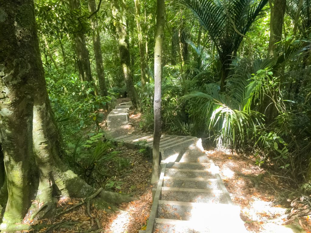
The descent from the Hakarimata summit was fantastic. This side of the mountain is more popular as a fitness walk, owing to the number of stairs. There are over 1,500 steps on the mountain, and I’m not sure whether it was easier to climb or descend them. We were pushed along by little plaques with inspirational quotes that were dotted along the walkway. Aside from the motivational Sir Edmund Hillary quotes, my favourite was one which said: “Sweat is just fat crying”. I had to laugh out loud at that one!
 Just some of the 1,349 stairs which wind their way up to (or down from) the Hakarimata summit).
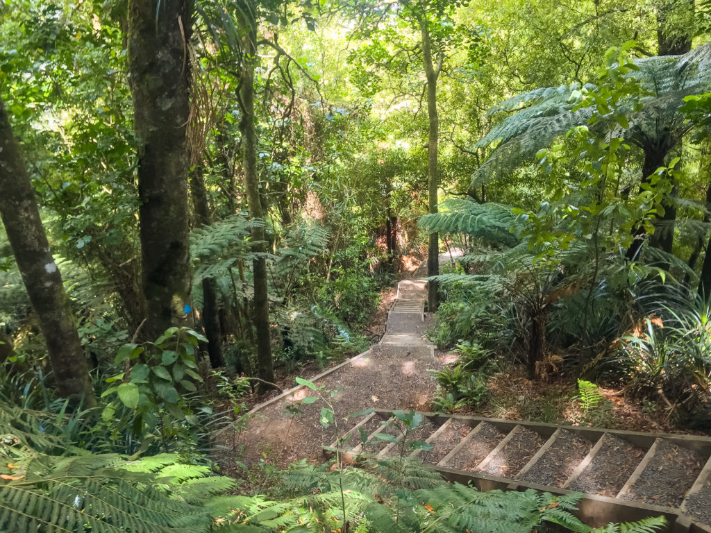
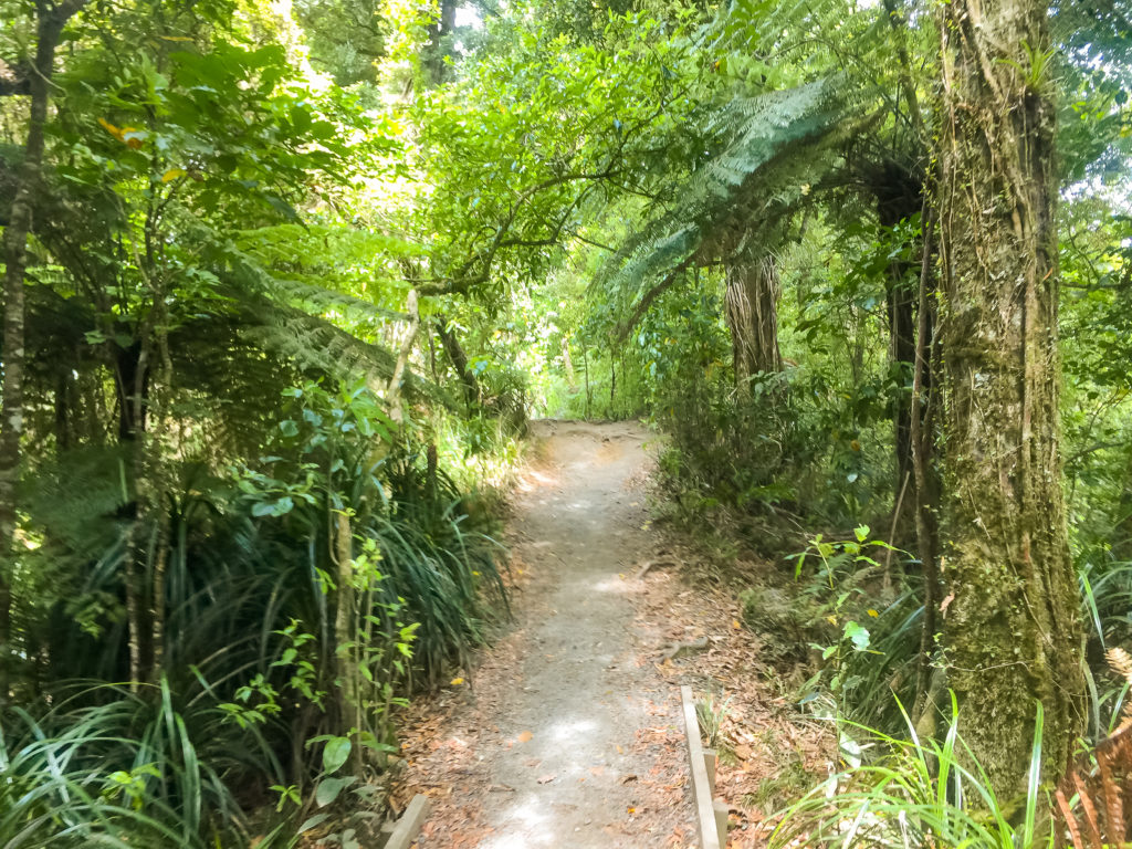 The track down from the summit (more popular with day hikers) is much wider and more well graded than the track up to the summit.
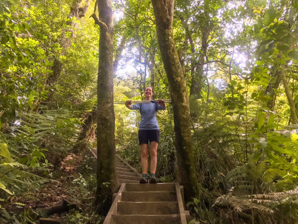 A pair of trees grow narrowly astride the track on the way down from the Hakarimata summit, as Julia demonstrates expertly here.
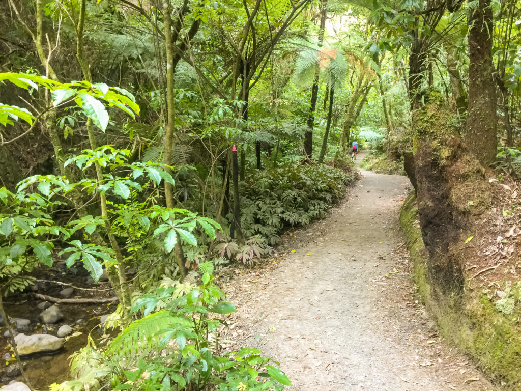
At the bottom, the track meandered along next to a stream for a little way before emerging into Ngāruawāhia township.
 Hiking down from the Waterworks Dam towards the end of the Hakarimata Walkway.
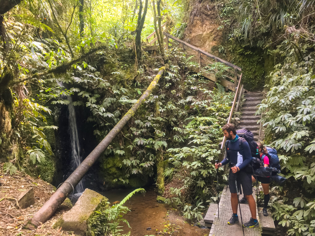 Our Hungarian companions stop for a brief break at the Waterworks Dam waterfall on the way down from the summit.
We spent some time taking photos of us in one of those standard seaside face-hole picture board things (I don’t know what they’re called but here is the photo)…
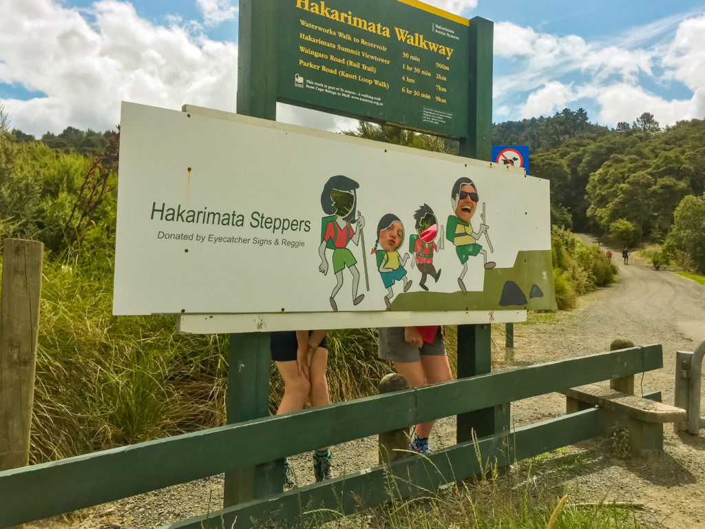 Julia and I pose at an English seaside-inspired cutout sign celebrating the Hakarimata Steppers (those who take on the 1,349 steps from the southern terminus in Brownlee Avenue to the Hakarimata Summit trig).
From there, we made our way to the bus stop. A brief check of the timetable revealed we had approximately 20 minutes until the next bus, which we spent hastily running around New World picking up some more luxuries for our final evening in Huntly.
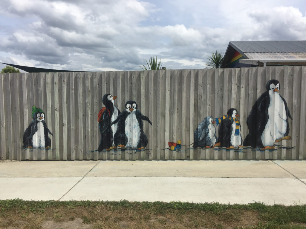 A cutely decorated fence full of penguins in Ngāruawāhia on the road walk to the bus stop.
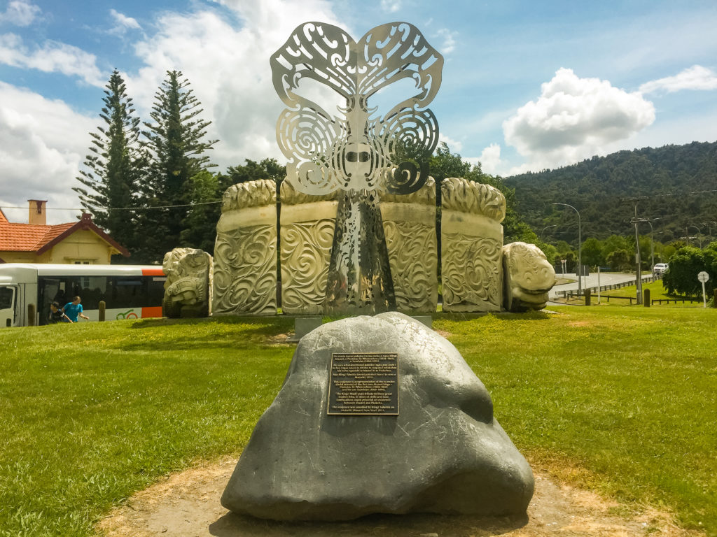 The Kīngitaanga Memorial at Ngāruawāhia represents the Māori King Movement, similar to the monarchy of the British Crown, hailed as a way of halting alienation of Māori property and customary rights at a time of rapid population growth from European settlers.
Before long, we were on the wonderfully air conditioned bus riding back to Huntly. It took less than 20 minutes, and we thanked the driver as we left. After checking the timetable for departures back to Ngāruawāhia tomorrow, we returned to our campsite to rest up for the afternoon.
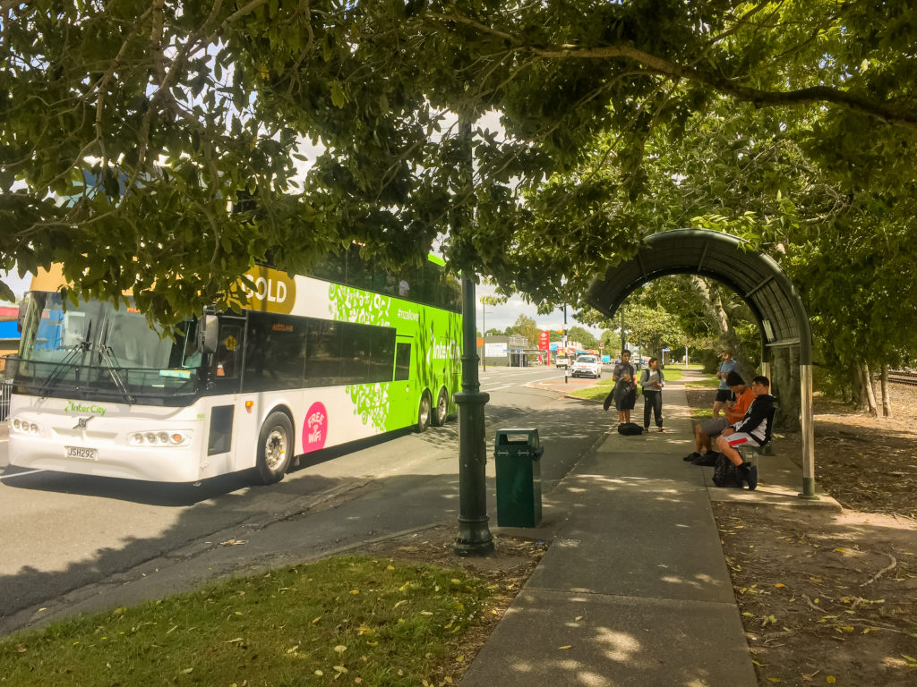 Waiting for the regional bus service back to Huntly at the Ngāruawāhia main bus stop.
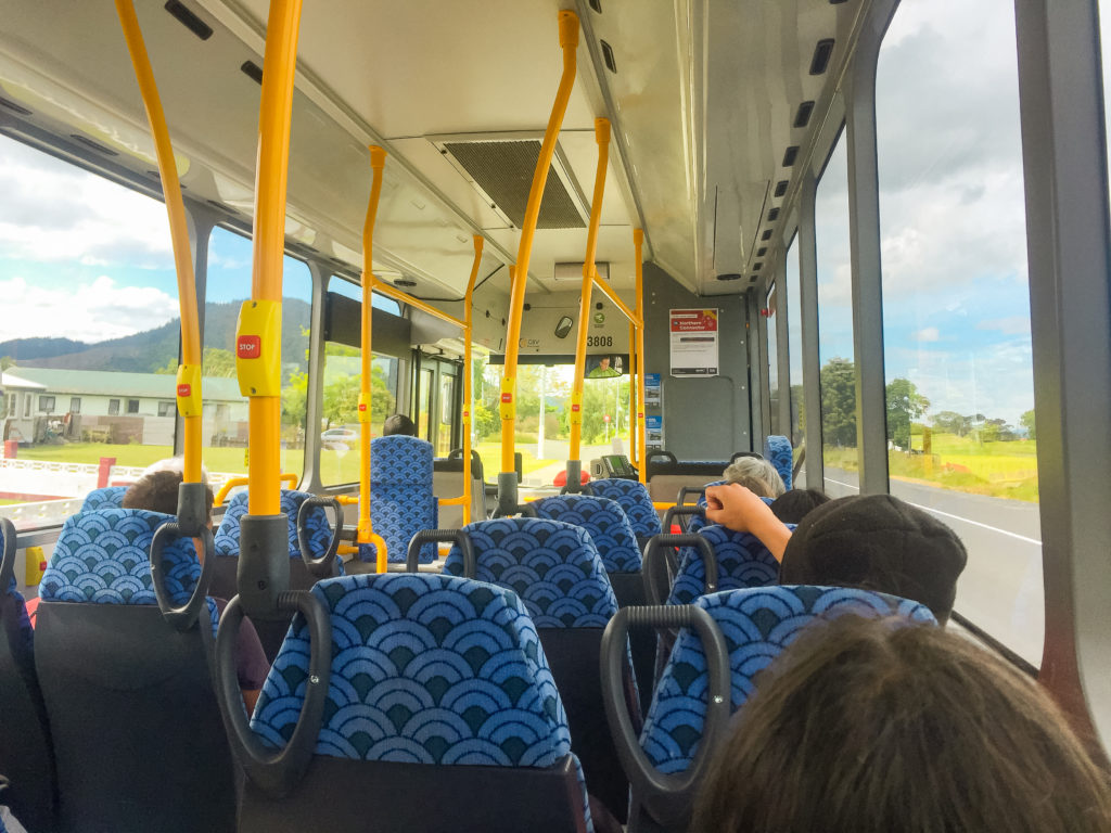 Enjoying the air conditioned environment on the regional bus service from Ngāruawāhia to Huntly.
The German couple surfaced about an hour later. They had also chosen to leave their tent at the campsite that morning, but instead of hiking the full Hakarimata Track walkway they had just done the Kauri Loop walk and then hiked back to Huntly. Julia and I couldn’t understand their reasoning.
After a brief conversation with them, Julia relayed to me that they were trying to hike the trail on a budget, and hadn’t realised how expensive it would be (especially the fact that they were having to pay for accommodation every night). I was baffled. For the sake of spending $8 on bus fares between them, they’d missed out on a beautiful day of hiking, and I felt painfully sorry for them. The trail mantra “Hike Your Own Hike” sprung to mind, and I forced myself to accept that this was their journey, not mine. They certainly seemed happy enough with their choice, but it seemed like a waste to me.
That evening we finished off the rest of the chocolate cake and enjoyed our final night of Huntly hospitality before rolling into bed with, for the first time, feet and legs that felt the closest to normal they had in a long time.
It was the perfect active recuperation day, and I slept happy and content, just like a baby.
prefer to watch?
Watch the full video from this section of Te Araroa below.