
Long White Gypsy uses affiliate links and is a member of the Amazon Services LLC Associates Program. If you make a purchase using one of these links, I may receive a small commission at no extra cost to you. See my Privacy Policy for more information.
If you’re looking for a scenic short walk in the Central North Island region of New Zealand, then the Aratiatia Rapids Walk to Huka Falls is just right for you!
The track is easy walking for all ages and levels, and is very green. There’s an abundance of things to see along the walk and whether you start from the Aratiatia Rapids or from Huka Falls, you won’t be disappointed!
Track Info
Dogs permitted (under control)
Mountain bikes permitted (Grade 2)
Track Notes for the Aratiatia Rapids Walk
| LOCATION | Taupō, Central North Island |
| TRACK GRADE | Easy walking track |
| TOILETS | At Huka Falls and Aratiatia Rapids carparks |
| WATER | Bring your own, 1-2L |
| PHONE RECEPTION | Excellent |
| TRANSPORT | Private car or town bus to Huka Falls |
| HAZARDS | Steep cliffs & drop-offs, track crosses near busy state highway |
| SPECIAL GEAR | Trekking poles, head torch |
prefer to watch?
Watch the full video of this trip.
Things to Know.
Travel to the Aratiatia Rapids
The most obvious way to access the Aratiatia Rapids Walk is by your own personal car. If you’re going as a group and don’t want to do the full 4 hour return trip, you could drop one car off at the other end so you can walk one way only.
If you’re in Taupō but don’t have your own transport you can use a local bus or shuttle service to get to the trailheads.
The Great Lake Explorer shuttle is a relatively new service which offers shuttles to both Huka Falls and Aratiatia Dam (as well as many other popular locations) for just $30 per day.
Alternatively the Taupo North local bus service does two runs past Huka Falls on weekdays only. If you’re a fast walker, you could probably make a return trip to Aratiatia Dam within the time it takes for the bus to return to Huka Falls. Follow the link to see the timetable.
Aratiatia Rapids Times
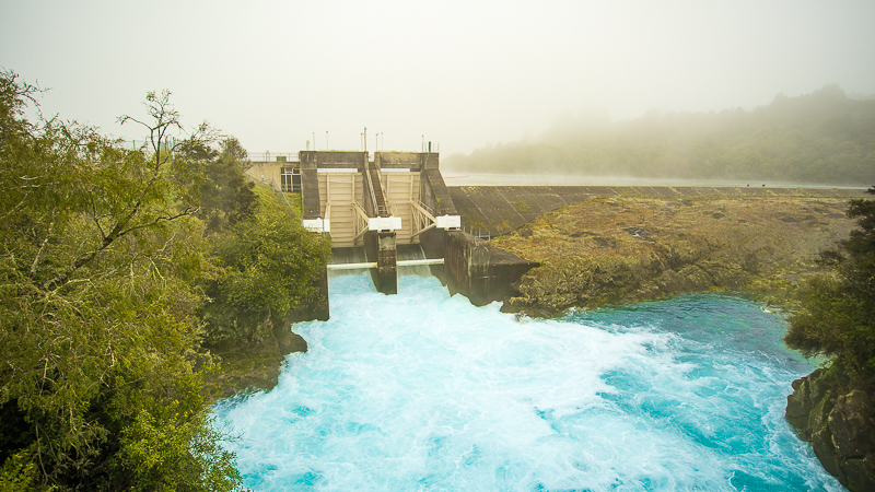
Aratiatia Rapids and Dam are the first on the Waikato River as it makes its way towards its estuary at Port Waikato. You might wish to time your walk to coincide with one of the regular Aratiatia Dam opening times, so you can watch the water fill up the gorge below the dam.
The dam is opened every day at 10AM, 12PM, 2PM (and again at 4PM during summer from 1 October to 31 March).
No Swimming
Each release of water is preceded by the Aratiatia Dam siren which sounds repeatedly for a short time prior to dam release.
It’s extremely dangerous to swim or kayak anywhere near the rapids or the dam. Even though there are scheduled dam releases every day, the dam can open at any time endangering the lives of people who might find themselves in the water.
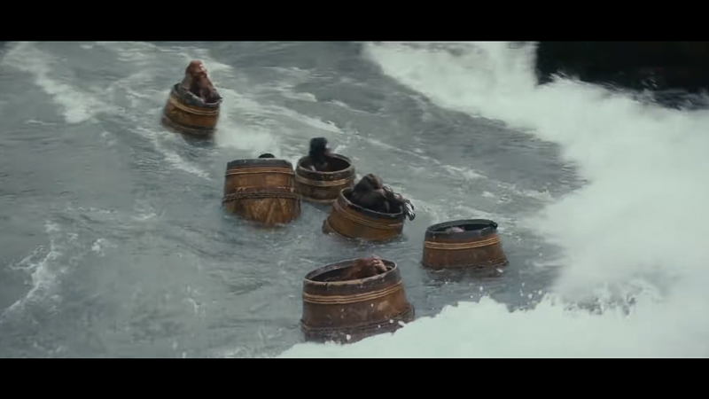
Lord of the Rings Filming
Recently, the Aratiatia Rapids became famous as the film location for the barrel escape scene in the hit movie THE HOBBIT: THE DESOLATION OF SMAUG.
Because of the danger, The Hobbit film crew did not put actors into the water here, instead only using this location to film scenes of the closed barrels tumbling through the rapids. They superimposed the actors later.

Shared Use Track
The Aratiatia Walkway to Huka Falls is part of a wider network of mountain biking trails in the Taupō region. As such, be prepared to share this (sometimes narrow) pathway with bikers. Bikes should give way to walkers, but exercise care when going round corners anyway as they can sometimes travel very fast.
Boat Rides on the Waikato River
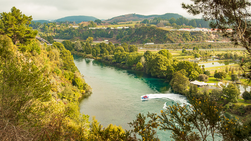
A major attraction in New Zealand, jet boating on the Waikato River draws thousands of tourists each year. In addition to the Rapids Jet (which travels the lower reaches of the Waikato River below the Aratiatia Dam) the Huka Falls Jet operates on the Waikato River just south of Taupō.
You’re likely to hear and see one or more of the Huka Falls Jet boats on the river as you walk along the Aratiatia Rapids Walk You may also see the tamer and gentler ride of the Huka Falls Cruiser as it makes its way toward the falls.
Booking details and timetables for these boat adventures can be found via the links above.

How to Get There.
The Huka Falls to Aratiatia Rapids Walk is a point to point track therefore it can be walked from either end. Each end is easily accessible by road, and has ample parking for cars.
Unless you have two cars (one parked at either end), you’ll have to return the same way you came, taking the total hiking time to 4 hours.
My preference is to start from the Aratiatia Dam. It avoids the need to rush the final part of the track to catch the dam opening, and if you’re only hiking the track in one direction it’s a nice end to your journey to finish at the majestic Huka Falls, one of the most visited tourist sites in the North Island.
Huka Falls start
Use the map above to get directions straight to your phone’s map app.
Travel to Huka Falls via Huka Falls Road. If entering Taupō from the north, turn right at the roundabout on State Highway 1 (if you go across the suspension bridge, you’ve gone too far), carry on along Wairakei Drive then turn left on Huka Falls Road after the rope agility course.
Follow this road for a few hundred metres until you get to the Huka Falls carpark on the left. Once parked, walk over the bridge over the Huka Falls and then turn left at the end of the bridge. Continue all the way to the final lookout over the waterfall, then head to the right following signs to Aratiatia Dam.
Aratiatia Rapids Walk Start
Use the map above to get directions straight to your phone’s map app.
Travel to the Aratiatia Dam via Aratiatia Road. If entering Taupō from the north, turn left at the State Highway 1 roundabout onto State Highway 5 towards Rotorua. Carry on past the lava glass gallery then turn right onto Aratiatia Road.
Continue along Aratiatia Road until you cross the dam bridge. There is a small carpark on the right just after the bridge. The track begins on a small dirt road which leads off the carpark on the upstream side of the river.


Track Grade & Fitness.
The Aratiatia Rapids Walk is classified as an Easy walking track by the Department of Conservation, and an Easy: Grade 2 mountain biking track, It’s suited to trampers with moderate fitness, capable of walking for 2-4 hours on even terrain.
The track is relatively flat although there is a gentle uphill elevation gain from the Aratiatia rapids end to the Huka Falls end, and two short hill climbs: the first to a viewpoint opposite the Wairakei Power Station (from both ends) and the second to a viewpoint immediately after leaving Huka Falls when returning to the dam.

Being graded for bikes, the track is well cut and formed in most places, with some slightly gravelly sections. After heavy rain the section between the State Highway 1 suspension bridge and Huka Falls can be muddy and slippery.

Facilities.
Facilities on the track itself are lacking, but there is the occasional bench to take a rest on at major viewpoints.
Toilets are located at the Aratiatia Dam carpark (just a long drop) and at the Huka Falls kiosk (flushing toilets). There are no rubbish bins along the track, so you’ll need to carry your rubbish with you.
Food & Water.
At roughly 2 hours in one direction, you should carry enough food with you to sustain you for a moderate hike on relatively easy terrain. Unless you have two cars (one parked at either end) you’ll need to have enough food for the return trip, which will take you around 4 hours. Opt for high-energy slow releasing foods such as nuts and raisins, carbohydrates and sugars like bananas, or even chocolate. You’ll also need to carry all the water you’ll need for the trip with you as there isn’t anywhere to fill up along the way. If heading in one direction only, you should be able to get by on 1L per person, but if walking in an out-and-back direction you’ll need to double this to 2L.
Seasonal Variations.
Being at relatively low elevation and close to a major town, the Aratiatia Dam walk can be completed at any time of year.
During the summer months, the section between Aratiatia Dam and the State Highway 1 suspension bridge can be very hot and dry as there is little shelter from the elements. Make sure you have good sun protection (hat, sunscreen, sunglasses) before setting out.
During the winter or after heavy rain, the section between the suspension bridge and Huka Falls can be muddy and slippery, as this section is mainly through bush on a compacted mud track. It also gets churned up by mountain bikers.
Waterproof and warm layers will keep you warm and dry, and short gaiters will help keep mud and dirt out of your shoes.
More Tracks In This Region

About Aratiatia Dam.
In the Māori language, Aratiatia means ‘stairway of Tia’.
Aratiatia Power Station (serviced by the Aratiatia Dam) is the first hydroelectric power station on the mighty Waikato River, 13km downstream from Lake Taupō and the Taupō Control Gates. It is currently operated by Mercury Energy.
The Aratiatia Power Station generates electricity via the flow of water through the dam when it is opened at certain times during the day. Each release lasts for 15 minutes, and is spectacular to behold.
Aratiatia Rapids Dam Opening Times
Summer (Oct – Mar)
10am, 12pm, 2pm, 4pm
Winter (Apr – Sep)
10am, 12pm, 2pm
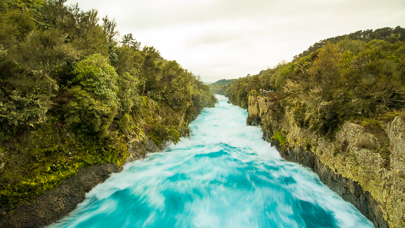
Prior to construction of the Aratiatia Power Station and Dam, the Aratiatia Rapids were the largest in Australasia and were in full flow every minute of every day. The Waikato River drops a staggering 28m in just 1km as its water tumbles over the rapids.

Although you can watch the dam releases from the bridge over the main road, it’s more scenic and spectacular to watch the water flow through the rapids from the designated viewing spots on the downstream side of the dam.
Cross the road from the main carpark and follow the green and yellow signs. After a short 5 minute walk you’ll come to a large carved stone with a Māori blessing.


Turn left here to the first of two viewpoints offering a high perspective of the rapids.


A further 5 minutes along the track you’ll also come to a second (sheltered) viewpoint with some seating at the farthest extent of the main rapids, still high above the river below.
The Route.
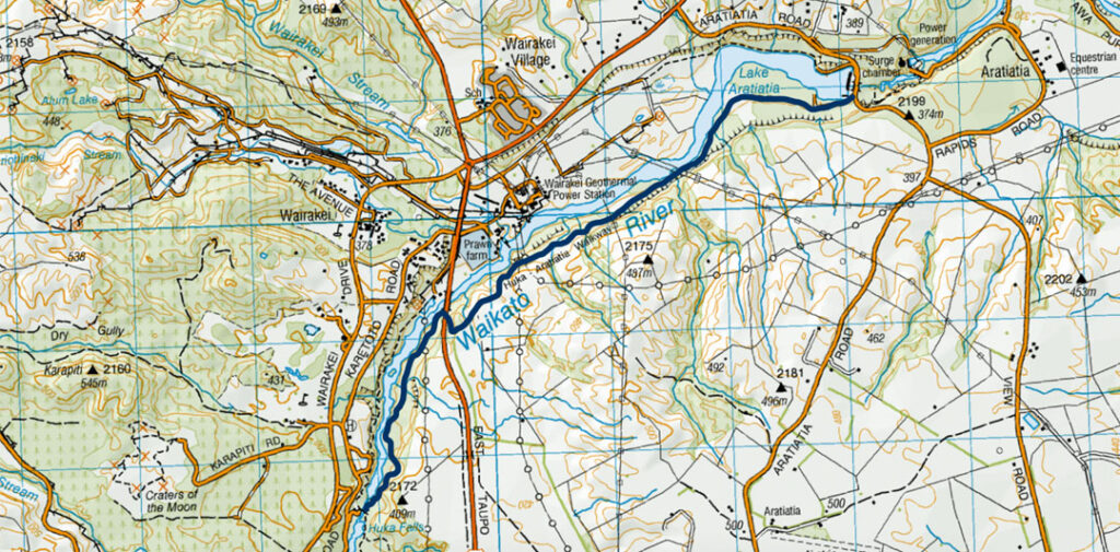
This route report describes a one-way hike of the Aratiatia Rapids walk in a southerly direction from Aratiatia Dam to Huka Falls.
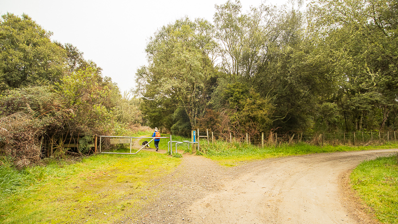
Once you’ve watched the Aratiatia Dam open and fill up the gorge below the gates, begin your walk from the trailhead in the carpark of the Aratiatia Scenic Reserve (on the upstream side of the road).

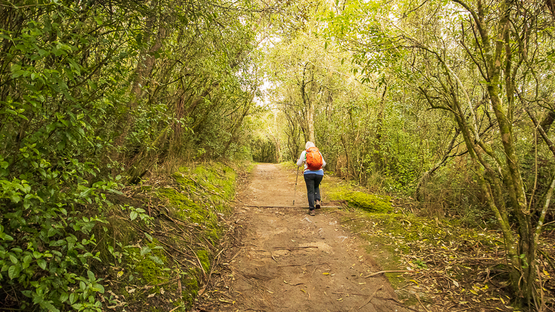
The track follows the course of the Waikato River for its entirety, but at varying distances from the river. Good views are on offer at various points.
The first section of the track from the carpark to the beginning of the first climb is relatively flat and uncovered (except for a few small shady spots as pictured below) so you’ll need good weather protection.

At the end of this initial flat section, the track climbs to a small lookout over the river with a bench seat if you need to stop for a rest. It’s a relatively short climb, but gets the heart pumping.
From the lookout you’ll get a good view of the track which you have come along as it makes its way along the banks of the river. Listen out for jet boats as they whizz their way along this section of the river to and from the dam.

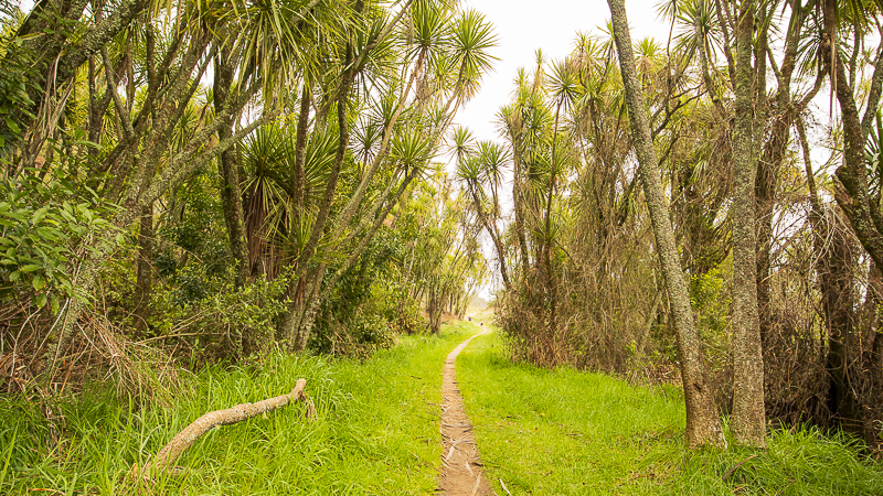
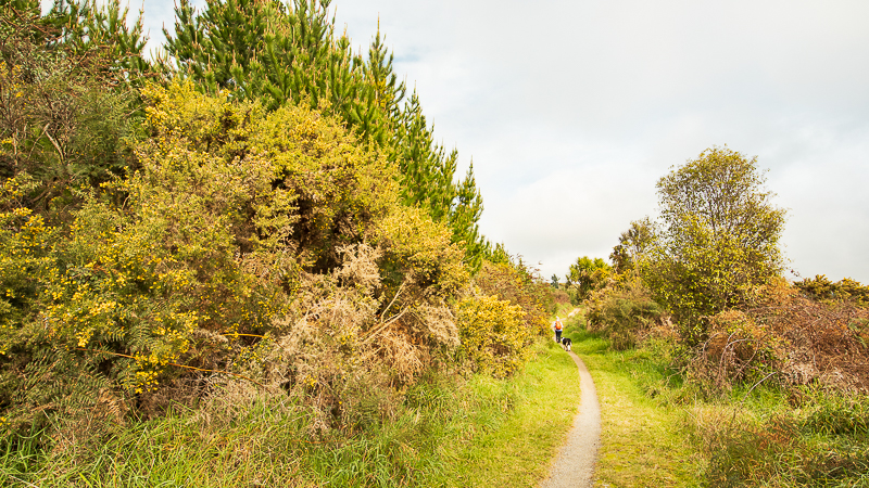
From the lookout carry on as the track runs along a narrow track which is bordered by gorse, pine trees and other small shrubs. This section of track remains unprotected from the elements as it undulates gently through the landscape.
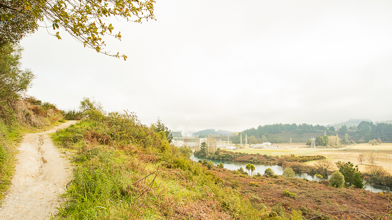
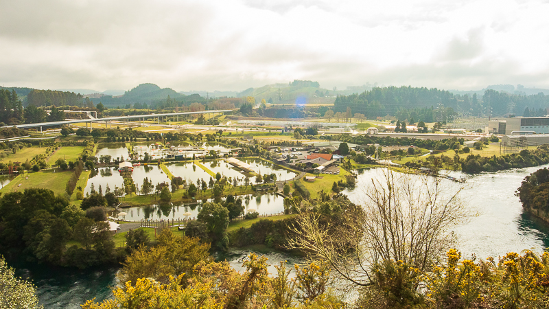
It’s not long before you’ll come to another viewpoint overlooking the Wairakei geothermal power station. The track narrows through this section, so make sure to watch your footing.


Across the river you’ll also be able to see the Huka Prawn Park (where you can catch, cook and eat your own prawns) as well as the launch site for the Huka Falls Jet.

From this second lookout, the track continues to meander alongside farmland on the outskirts of Wairakei and Taupō township. The Aratiatia walkway varies from narrow in places, to wide enough for two or three people to walk abreast.
There are some small hilly sections that require a little bit of effort, but for the most part this is still relatively easy walking. It is still very exposed to the sun through this section.

Eventually the track approaches State Highway 1 and you’ll begin to hear the noise from passing traffic. If you have a dog with you, it may be a good idea to put them on the lead at this point. Although they’d have a hard time getting to the road through the gorse, it’s better to be safe than sorry.
Our pup doesn’t like the rumble and sound of traffic (especially large trucks) passing on the bridge ahead, and on the other side of the bridge there’s a small path up to the highway which doesn’t have a fence or gate.

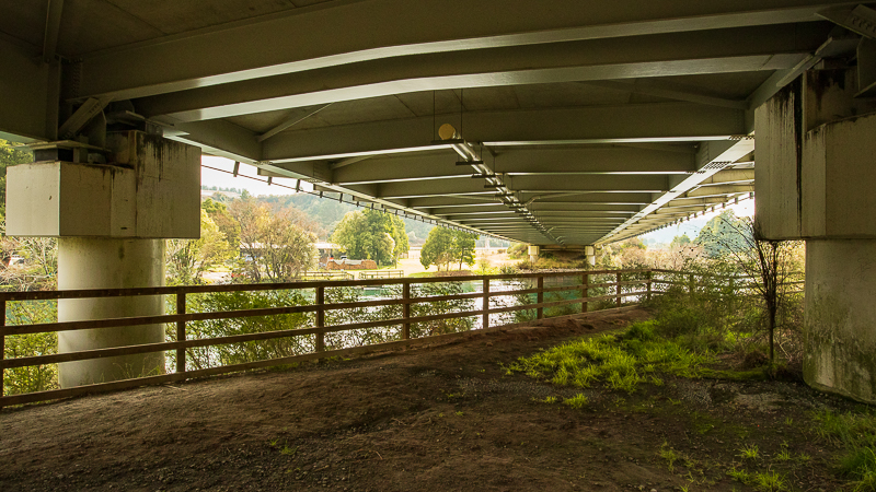

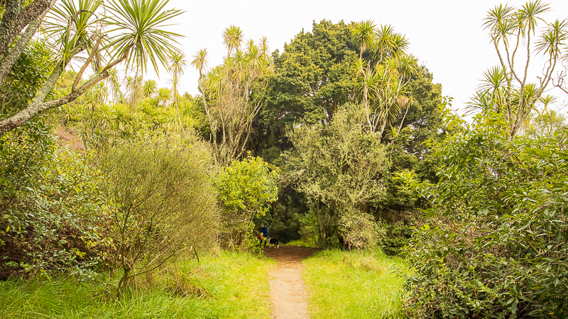
Once on the other side of the bridge you’re away from the traffic noise and back into the peaceful native bush. This section is deceptively long, but there are one or two spots to see the river to keep you busy and take a small break.


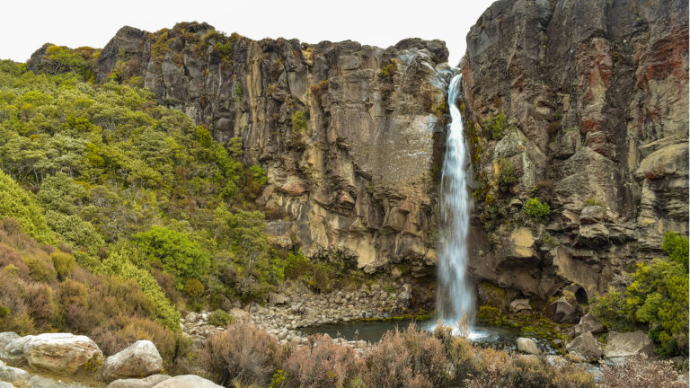
Towards the end of this section you’ll begin to notice the bush becoming thicker and denser. Eventually, the track begins a gradual climb to the second lookout, this time over Huka Falls. It’s a relatively gentle climb, and you’ll hear the noise of Huka Falls slowly getting louder as you get closer.
Take a small break at the Huka Falls lookout to admire this natural attraction from a high viewpoint, before continuing steeply downhill to the lower viewpoint and Huka Falls carpark. Make sure to stick to the walking track (veer right) and not the mountain bike track on your way down to the Huka Falls reserve.

**If you accidentally find yourself on the bike track, remember to stay aware and give way to bikers. Don’t worry – all tracks eventually lead to the waterfall.
From the furthest viewpoint from the Huka Falls bridge you can observe the final moments of the Waikato River’s journey as it tumbles over the falls into the plunge pool below.
Continue along the pathway towards the Huka Falls bridge and carpark, catching glimpses of the crystal clear blue water as it’s squeezed through the narrow rock passage on its way downstream.
At the bridge, take a look both up and downstream and allow yourself to feel the force and flow of the water passing underneath.
The call of the wild at heart is prominent here, and (although prohibited) you may be lucky enough to spy a few brave daredevil kayakers attempting the death defying run over the falls.

From here, either pick up your prearranged shuttle or other transport from the Huka Falls carpark, or turn around and return to Aratiatia Dam via the same route.
Final Thoughts.
The Aratiatia Rapids Track is an excellent way to spend some time exploring the northern Taupō region with its plethora of tourist attractions and grandeur of the Waikato River.
By following the advice in this Track Guide, you should have a safe and enjoyable trip, but if you’d like to know anything else about this track feel free to contact me here or on Instagram.