
Long White Gypsy uses affiliate links and is a member of the Amazon Services LLC Associates Program. If you make a purchase using one of these links, I may receive a small commission at no extra cost to you. See my Privacy Policy for more information.
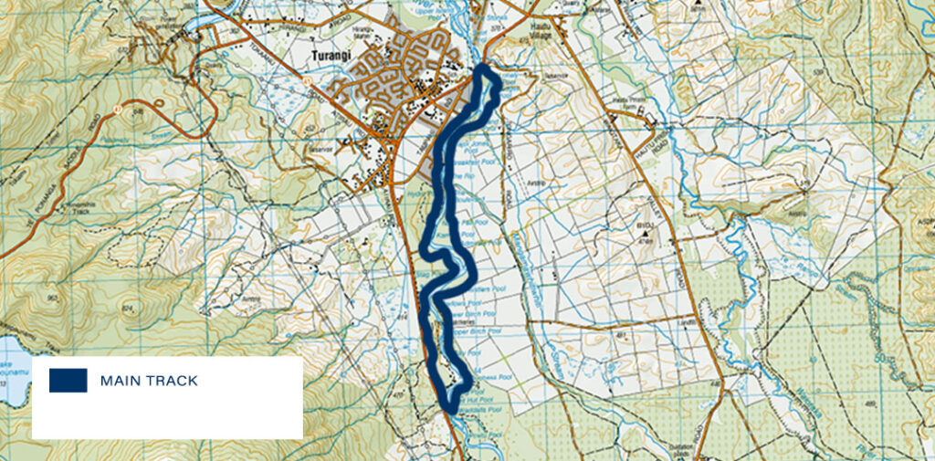
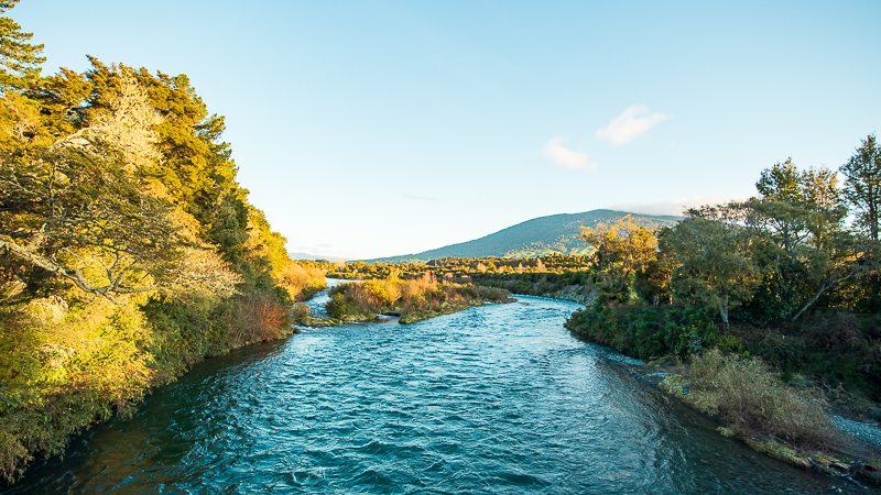
The Tongariro River Trail is one of the most beautiful southern Lake Taupō walks, meandering along the banks of the Tongariro River.
One of the main tributaries into Lake Taupō (the largest freshwater lake in New Zealand and second largest in Oceania) the Tongariro River is New Zealand’s most fished river (being famous to anglers for its rainbow trout fisheries).
The Tongariro River Trail is shared use by mountain bikers and hikers, and dogs are permitted on the trail off leash between October and August as long as they are under control.
Track Info
Dogs permitted (under control)
Mountain bikes permitted (Grade 2)
Track Notes for the Tongariro River Trail
| LOCATION | Tūrangi, Central North Island |
| TRACK GRADE | Easy walking track |
| TOILETS | Taupahi Road carpark & Red Hut carpark. |
| WATER | Bring your own, 1-2L |
| PHONE RECEPTION | Excellent |
| TRANSPORT | Private car, or bus to Tūrangi |
| HAZARDS | Swift moving water, exposed cliff edges |
| SPECIAL GEAR | Trekking poles, head torch |
prefer to watch?
Watch the full video of this trip.
Things to Know.
Shared Use Track
The Tongariro River Trail is a shared use track between walkers, mountain bikers and dog owners. Be considerate of other trail users, move to one side if someone needs to pass, keep dogs under control at all times, and ride slowly around other trail users. Bike riders must give way to walkers.
Angler’s Paradise
The middle reaches of the Tongariro River (alongside which this track runs) are a mecca for fly fishing enthusiasts the world over and you’ll enjoy watching some of the action from the trail.
There are numerous angler’s access tracks leading off the main track and down to the Tongariro River. These tracks can be steep and end in sudden drop-offs or cliffs above the fast-flowing water of the river. Keep children and animals under supervision at all times.


Endangered ducks (Whio)
The banks of the river are home to the endangered whio duck which nests between August and October each year. Keep dogs under close supervision during nesting season to avoid danger and stress to the birds.
How to Get To The Tongariro River Trail.
Use the map above to get directions via your phone’s map app.
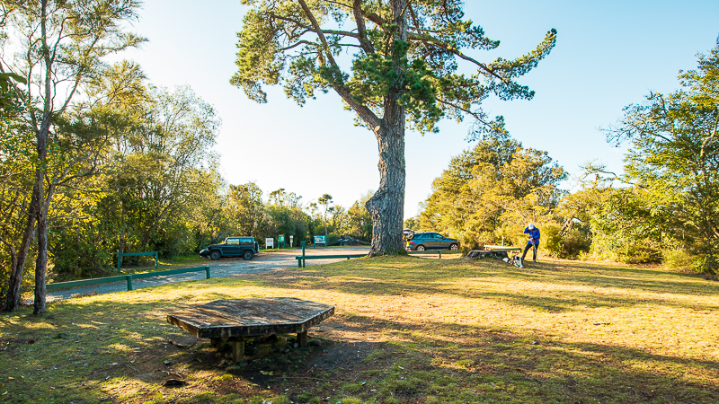
The Department of Conservation recommends that hikers wishing to avoid crossing busy State Highway 1 should start their hike of the Tongariro River Trail at the Tūrangi iSite. To avoid the road altogether, you can begin from a number of carparks on the river side of SH1. The largest is the carpark at the Taupahi Reserve (just off Taupahi Road). You can join the loop track from either the southern or northern end of the reserve, with the northern entrance offering the quickest access to the lookout for those not wishing to complete the full loop.

The Tongariro River Trail can also be enjoyed in smaller sections if that’s your preference, with many other access points, including:
- via the SH1 bridge over the Tongariro River (parking opposite the coffee cart) at the northern end of the track;
- the Red Hut carpark at the southern end of the track; and
- other carparks at the end of Kutai, Koura and Poto Streets on the true left side of the river.
Track Grade & Fitness.
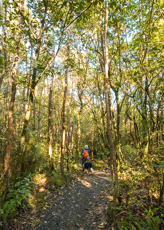
The Tongariro River Trail is graded Easy walking track by the Department of Conservation, and is also an Easy: Grade 2 mountain biking track. The route is relatively flat and wide in most places suitable for two people to walk abreast of each other and gravelled for ease of use by bikes.

The section of track between Red Hut and the Major Jones bridge if going clockwise is narrower and more akin to a normal walking/tramping track. Keep your wits about you and be prepared to step aside for bikes.
Depending on which direction you’re hiking (clockwise or anti-clockwise), there are two inclines on the route which may get the heart pumping.
The first is the climb to the lookout at the northern end of the track, if approaching from the SH1 bridge. If climbing from the other side, the route to the lookout is much gentler, but longer.
There’s also a small climb not long after leaving the Red Hut bridge in an anti-clockwise direction, which consists of a steep switchback and set of stairs. If you are coming from the other direction, you’ll be walking down this slope instead.
Beginner and amateur day hikers as well as young families will enjoy this day hike, which can be enjoyed in its entirety or in smaller sections with ease of access to many points along the track.
Facilities.
This Tongariro River walk features the occasional bench to sit on, with larger benches at major stopping places such as Red Hut.
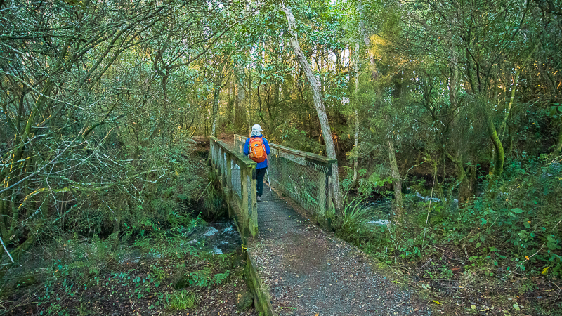
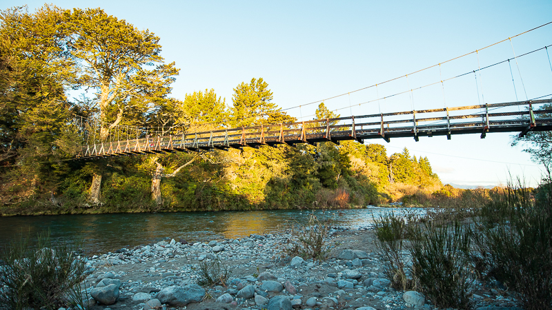
All crossings of the Tongariro River are bridged by swing bridges. Animals and young children may be wary on the swing bridges and should be supervised carefully.
There is a toilet block at the Taupahi Road carpark, and a long drop toilet at the Red Hut carpark.


Food & water.
There’s nowhere to fill up your water bottles along this track, so you’ll need to ensure you carry enough with you for the full hike. I recommend at least 1.5L per person as this is quite a lengthy trip.
Make sure you pack plenty of food to sustain you for this track. Although this is not a particularly strenuous walk, you should always carry a supply of emergency high-energy food for a quick pick me up.
More Tracks In This Region

About the Track.
Click on the image below to see a Tongariro River Trail map on the NZ Topo Maps website.
Culture & History
You can’t help but feel connected to the land as you embark on this Tongariro River walk. In fact it made me wonder about all the people who have walked the banks of this river for centuries before me.
To Māori (as to many other cultures worldwide), water is the essence of life. In Māori legend, Gaia or Mother Earth is known as Papatūānuku, and water is her blood.
As maunga (mountains) are important to the history of each iwi (tribe) so waterways are the same. They are not only sources of taonga (precious materials and treasures) but also for travel to wāhi tapu (settlements and sacred sites).
As maunga (mountains) are important to the history of each iwi (tribe) so waterways are the same. They are not only sources of taonga (precious materials and treasures) but also for travel to wāhi tapu (settlements and sacred sites).
Māori were the first to settle this region 700 years ago, and Ngāti Tūwharetoa have occupied this land since. Ancient chiefs, including Tūrangitukua, were instrumental in helping settlement and as a result the hapū (sub-tribe) which settled in the southern Lake Taupō region named their settlement Tūrangi after him.
Unlike many volcanic environments elsewhere in the world, the underlying soil at this time was harsh and Māori found it difficult to grow the staple of their diet – the kūmara (sweet potato) – in the unfertile and ashy soil.
This drove away the first European settlers, until their eventual return in the 1860s, but it still took another 90 years for the land to begin prospering as a result of clearing and fertilisation.
Around this time, the Tongariro Power Scheme was created, diverting water to the Tokaanu and Rangipo Power Stations and encouraging the growth of the small sleeping settlement of Tūrangi.
Walking the Tongariro River Trail
Due to the various points of access there are numerous ways in which you can hike this track, from short 20-30 minute excursions to a full 3-4 hour circumnavigation of the loop.
Following is a description of the Tongariro River Trail as split into its various sections (defined by access to a convenient carpark).
You may start from whichever point you wish, and walk in either a clockwise or anticlockwise direction (although a clockwise route is marginally easier).
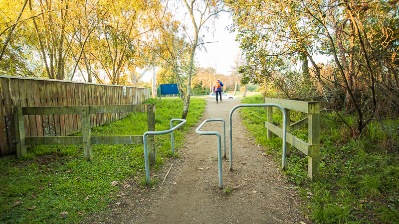
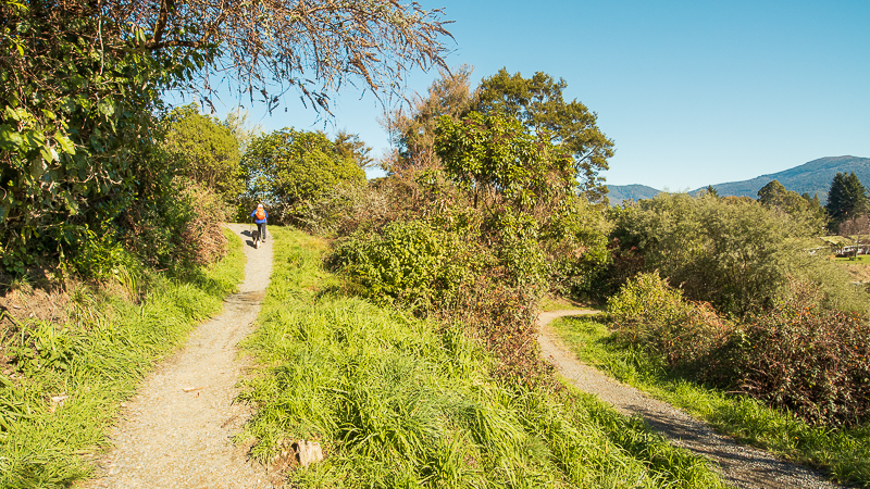
Taupahi Reserve to State Highway 1 Lookout
After parking at the Taupahi Reserve carpark, make sure to use the bright green toilet block before setting off on your walk.
Join the track in any direction from here. An anti-clockwise route takes you along the true left bank of the river towards the Major Jones Bridge. A clockwise route takes you towards the State Highway 1 bridge and lookout.
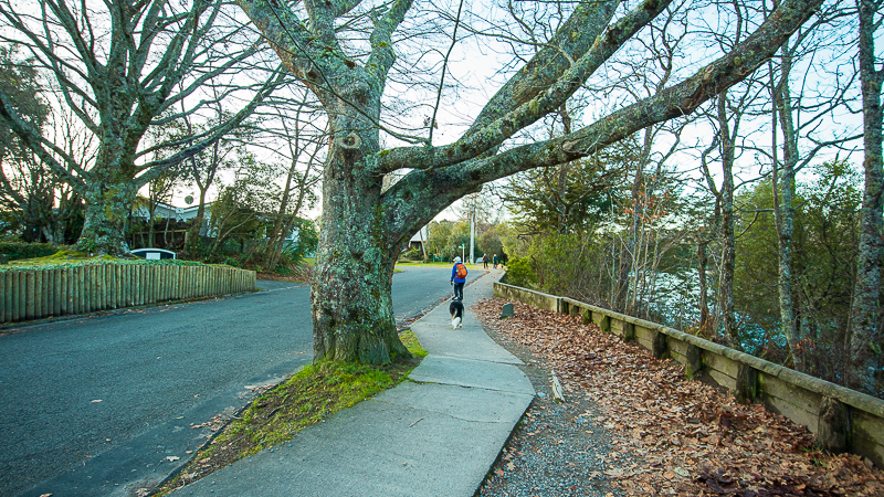
Heading clockwise, set out on a wide gravel track along the riverside residential area for approximately 15mins before reaching the road bridge at State Highway 1. Use the designated crossing point to cross to the other side of the road and walk over the bridge on the footpath provided.
On the other side of the bridge, cross the road again or head to the left to walk underneath the bridge to the other side of the road.


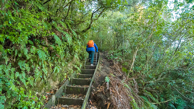
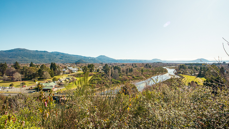
Once across, begin a short but steep climb to the lookout. The track comprises a narrow switchback style for a short 5 minute climb until you reach a bench which marks the top.
From here, admire panoramic views of Tūrangi township, the Tongariro River, and Mt Pihanga beyond.

State Highway 1 Lookout to Major Jones Bridge
Continuing in a clockwise direction, the track after the lookout is flat and still narrow for a little way. Be wary of bikers in front and behind, and be prepared to step aside if necessary. Occasionally you’ll see new peeks of the river environment below.

After a short way the track begins a slow and gradual descent. This is much easier on the knees than the climb up, and is more sheltered from the sun.
At the bottom of the descent the track penetrates into the trees where it now follows the true right bank of the river. Here and there you’ll pass access tracks down to the river. Be careful of children and animals as some end abruptly at the top of small cliffs over the roaring river below.


This section of the track is well sheltered from the weather being largely covered by trees. After approximately 20 mins you will come to the Major Jones Bridge intersection where you can decide whether to carry on in a clockwise direction (slightly easier), or cross the bridge and continue anti-clockwise on the opposite bank.


Major Jones Bridge to Red Hut Carpark
This narrative will continue to follow a clockwise route to Red Hut bridge.
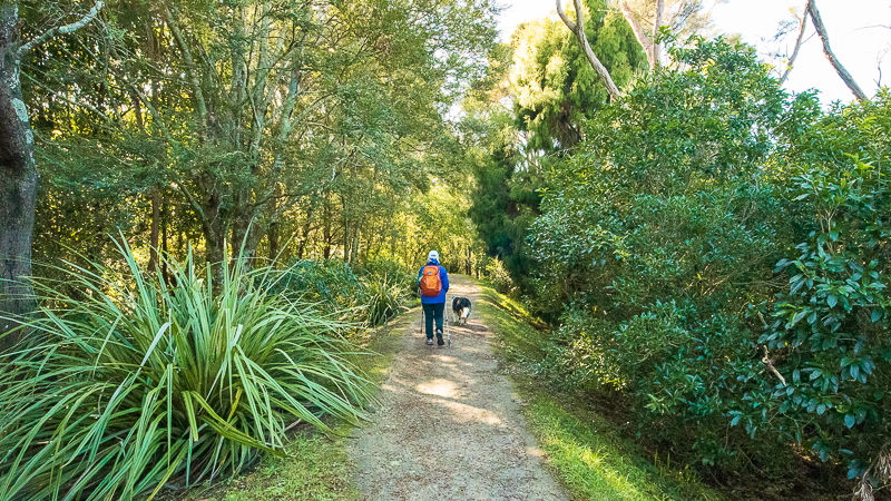
Continuing along the same side of the river (without crossing the bridge) the track once again delves into the tree and bush cover which adjoins the nearby farmland. You’ll lose sight of the river almost immediately and the track doesn’t offer any more sweeping vistas of it (unless using the angler’s tracks) until you reach Red Hut bridge.
Native trees and ferns adorn the sides of the Tongariro River Trail, and after 5-10 minutes you’ll cross a picturesque wooden bridge over a small tributary.

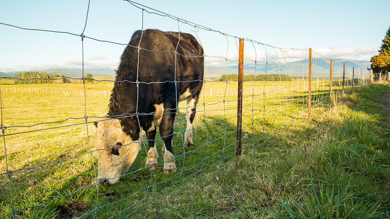
From here, the track weaves in and out of the bush next to the fenceline of the adjoining paddocks. You’ll likely see sheep and cows in the fields. Avoid spooking the livestock by keeping dogs and children well under control. Do not cross the fence into the paddocks as these are working farms.


The track follows the paddocks for approximately 25 minutes before heading back into the trees. Although almost imperceptible, the track has indeed climbed a fair way above the river below and after about 20 minutes you’ll descend a set of stairs and a steep switchback down to another wooden bridge over a small stream.


From here it’s only 5-10 minutes to Red Hut bridge. This swing bridge is narrower and more rickety than the Major Jones Bridge, with larger spaces between the rungs. Once across, follow the track up a small slope before reaching the Red Hut carpark. A grassy area on the far side of the carpark has an octagonal bench and a long drop toilet.

Red Hut Carpark to Tongariro Trout Centre
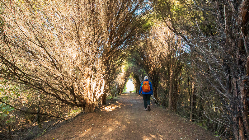
From Red Hut carpark the Tongariro River Trail now runs beside busy State Highway 1 for a fair distance before heading back to the river banks. Immediately after leaving Red Hut you’ll dip down into a lowland grass/marsh area where a boardwalk winds between flax bushes and long grasses.
From here, it’s back into the bush again for a short distance, at one point walking down a small sealed access road past an abandoned building, before emerging at the Tongariro Trout Centre carpark.
The centre is open every day from 10am to 4pm. Here you can find out much more about fly fishing the Tongariro River, and why Tūrangi is the ‘Trout Fishing Capital of the World’. For more information about what’s on offer at the Tongariro Trout Centre, click here.


Tongariro Trout Centre to Taupahi Reserve
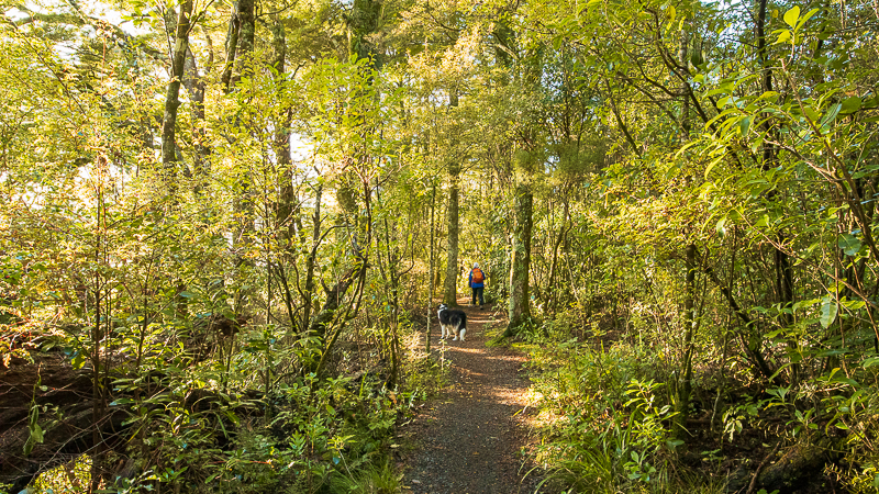
From the Trout Centre the track again heads back into the trees and continues along a narrow trail which winds through the bush. This section of track is very picturesque with lots of ferns and greenery lining the trail.
The beauty is lost somewhat by the proximity of the busy highway. At various points the track passes very close (within 10m) of the road, making it noisy but also dangerous. Although there is a small bank and a small screen of vegetation, there are some places where particularly adventurous children or dogs might be able to get onto the road, so keep them under close supervision (or put dogs on a leash to be safe).

You’ll cross another small 4WD access track, but keep following the main signage for the trail. Shortly after the track you’ll encounter a junction with a loop track which leads off to the left. The loop eventually joins back up with the main track although is slightly longer (not by much). Continuing on straight follows the banks of the true left side of the river back to the residential area.
From here, the track passes houses and fishing lodges as it winds along the river’s edge. There are plenty of places to stop and watch the anglers in the river below before again reaching the Major Jones Bridge.

Walk out onto the bridge if you haven’t already crossed it, or even venture down to the river’s edge here for a quick photo before pushing on another 10 mins or so back to the Taupahi Reserve carpark. This section of the Tongariro River Trail sometimes pops out onto quiet roads, but mostly is along a formed path between the river on one side and houses on the other.
Final Thoughts.
The Tongariro River Trail offers a fantastic opportunity to explore an historic recreational fishing environment in the central North Island region from the banks of Lake Taupō’s largest tributary, the Tongariro River.
By following the advice in this Track Guide, you should have a safe and enjoyable trip, but if you’d like to know anything else about this track feel free to contact me here or on Instagram.