
Long White Gypsy uses affiliate links and is a member of the Amazon Services LLC Associates Program. If you make a purchase using one of these links, I may receive a small commission at no extra cost to you. See my Privacy Policy for more information.
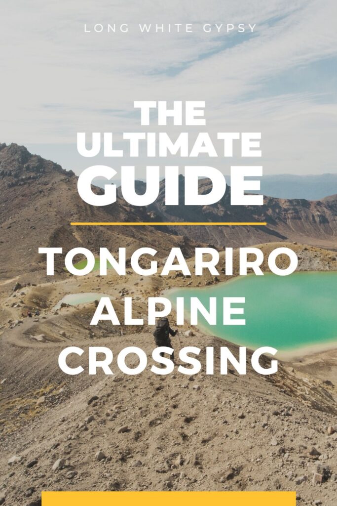
Welcome to this Tongariro Crossing Guide – your ultimate resource for conquering the best one day walk in New Zealand – the Tongariro Alpine Crossing.
This unforgettable hike takes you through some truly unique landscapes, from vibrant emerald lakes and steaming craters to alpine meadows and glorious views across the lakes and mountains of New Zealand’s UNESCO world heritage listed Tongariro National Park.
This guide will provide you with all the information you need to plan a successful Tongariro Crossing hike. I’ll take you through the basics of what to expect, from gear and clothing packing lists to tips for preparation and some of the most commonly asked questions about hiking in this special volcanic region. Read on for your comprehensive Tongariro Crossing Guide!
Why Should You Hike the Tongariro Crossing?
On the Tongariro Crossing you’ll find spectacular views and an amazing experience – all in just a single day! Considered one of the most popular day hikes in the world, the Tongariro Alpine Crossing attracts thousands of visitors each year.
The Tongariro Crossing requires lots of planning and preparation, as it can be challenging for novice hikers. For your safety and the safety of others, please stick to the marked trail at all times and respect this precious environment by following Leave No Trace principles.
You’ll be trekking across Mount Tongariro, through volcanic terrain with both physical and environmental hazards. There are steep climbs, exposed sections and active volcanoes on this trek. Take note of all warning signs and get ready to turn back if an alert or warning system is activated.
Finally, the Tongariro Crossing’s alpine environment means weather can change quickly and drastically at any time (snow can fall even in summer!). Always pack appropriate clothing for any conditions, an emergency means of communication and plenty of water and snacks.
Tongariro Crossing Map.
Here’s a Tongariro Crossing map showing the track and facilities along the way to help you plan your adventure.
Tongariro Crossing Guide – What to Expect.
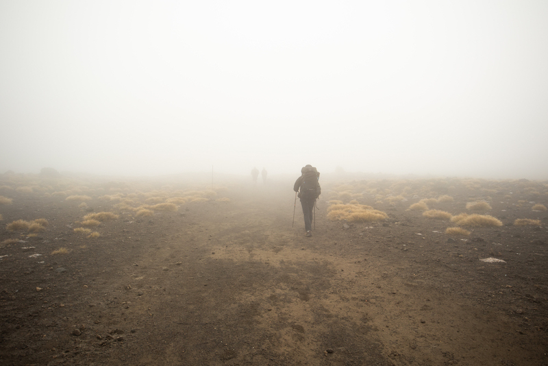
The Tongariro Crossing track is one of the most spectacular walks in the world, with beautiful views and stunning scenery. But don’t let that fool you – it’s not a walk in the park! You need to be prepared for anything. Weather and conditions can change rapidly on Tongariro even from hour to hour.
Why the Word “Alpine” Was Recently Added to This Track
Due to the number of injuries and rescues each year on this trek, the Department of Conservation and local iwi are trying very hard to get the message across that the Crossing is not just a walk in the park (as is so often portrayed on social media).
The Crossing is marketed by many bloggers, tourist companies and visitor centres as being a “relatively straightforward” hike which “thousands of tourists complete each year”. Because of this downplay, many hikers every year underestimate the skill required and weather conditions on this trek, leading to emergency rescues and even deaths.
The word “Alpine” was added to the name of this popular day hike in 2007 to help draw attention to the real nature of the trek and to help aspiring hikers realise the dangers it comes with.
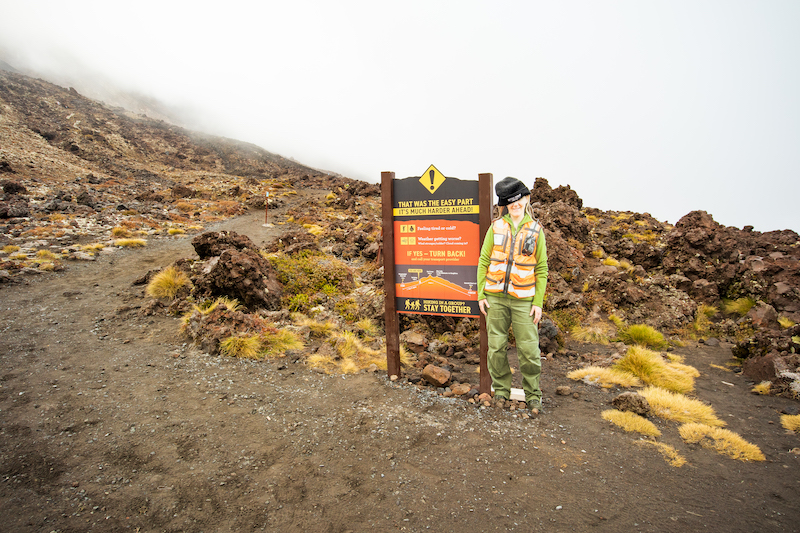
I’ve broken the first part of the track before Red Crater into the following sections. To stay safe you’ll need to assess whether it’s safe to continue at the end of each section.
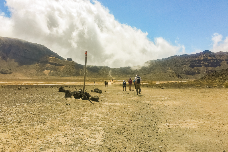
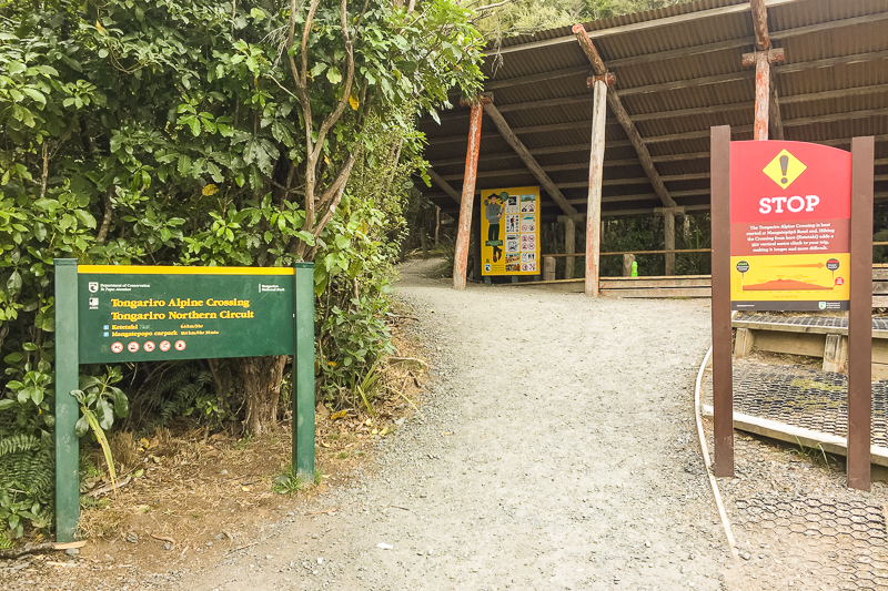
Mangatepopo Carpark to Soda Springs
The starting point for the Tongariro Crossing is at Mangatepopo carpark. The first part of the track takes you through the Mangatepopo Valley to the Soda Springs side trail.
Along the way, you’ll pass Mangatepopo Hut which is the first stop on the popular Tongariro Northern Circuit. Although the track looks relatively flat it is in fact a gradual incline.
Don’t be fooled if the weather is good through this section. This part of the track is very sheltered from the prevailing weather. Plus, you still have almost 1,000m of elevation to climb – it can get much worse higher up.
A little further on from the Soda Springs junction there’s a sign prompting you to assess how you and the members of your group are feeling. If you’ve struggled to walk this first bit, it only gets harder from here.
Distance: 4.5 km / 2.8 mi (approx.)
Suggested time to complete: 1hr to 1hr 30m
Devil’s Staircase
On a clear day, the Devil’s Staircase offers outstanding views of Mangatepopo Valley from above. The Devil’s Staircase ascends 200 vertical metres in a very short distance with over 300 stairs. You need to be relatively fit to complete this section of the track. Take plenty of breaks and enjoy the views along the way.
There’s a misconception that this is the most difficult part of the track, but that’s not actually true. The climb to Red Crater is much more demanding so if you’re struggling here you should turn back.
Distance: 2 km / 1.2 mi (approx.)
Suggested time to complete: 1hr to 1hr 15m
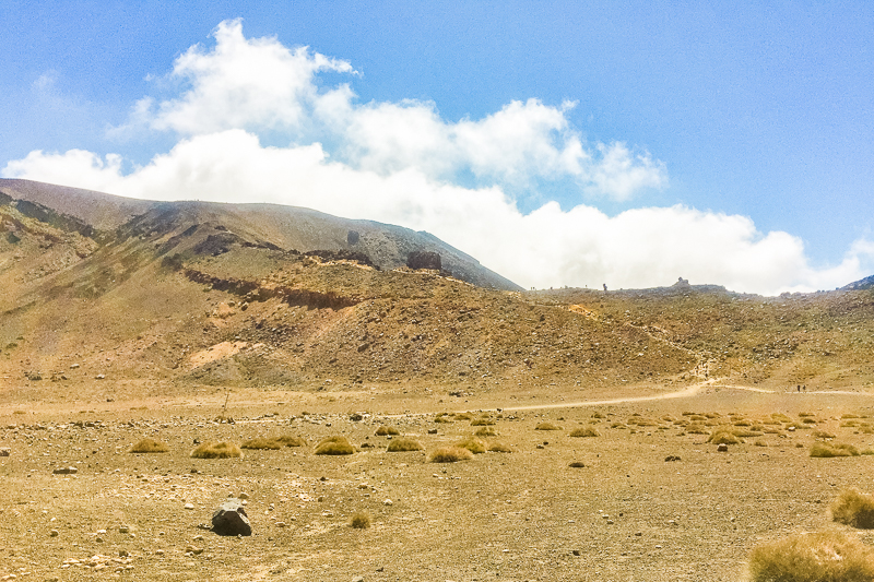
South Crater Traverse
At the top of the Devil’s Staircase is the flat expanse of South Crater. On a sunny day it’s a beautiful spot to take a short rest with views down the Mangatepopo Valley. Make sure you’re wearing plenty of sunscreen – the sun and UV is strong at this altitude and you’ll burn quickly.
South Crater is a unique meterological environment. Low cloud and wind often swirl around the crater and you may find visibility is very low. Blue and orange poles mark the route across. Turn back if visibility is so bad that you’re struggling to see the next marker or the wind is blowing you around.
Distance: 1 km / 0.6 mi (approx.)
Suggested time to complete: 30 min to 45 min
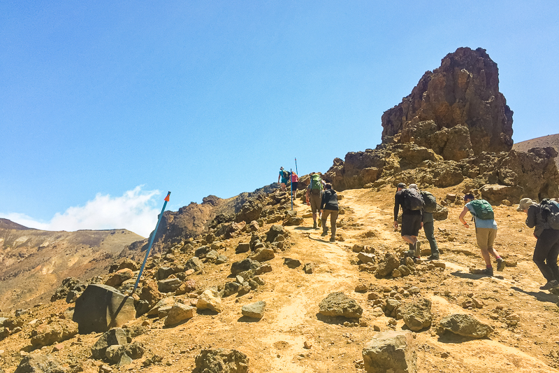
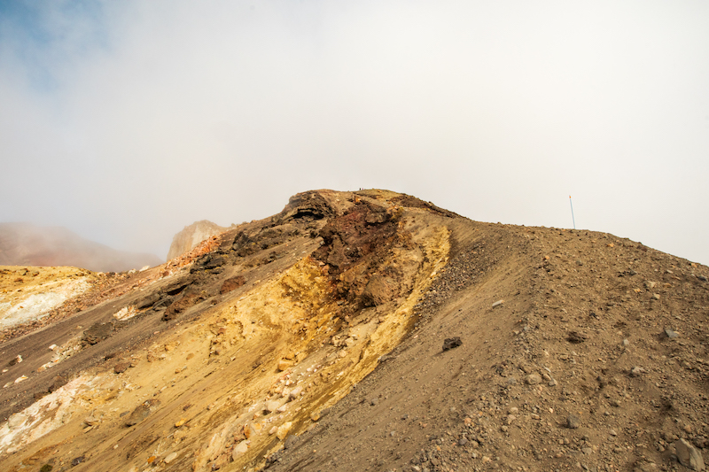
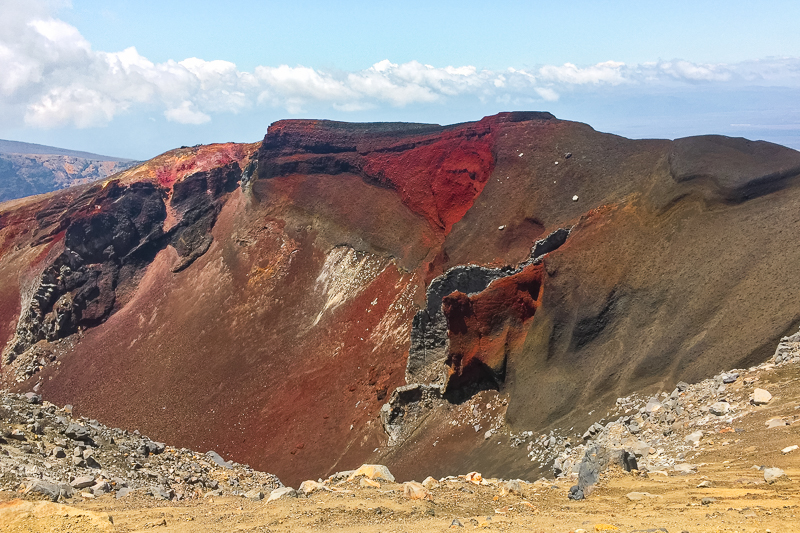
Climb from South Crater to Red Crater
Your final point of assessment is at the bottom of the climb to Red Crater (far end of South Crater traverse). Assess the weather conditions and your fitness levels again here. If you’re not feeling strong or the weather is closing in, it’s much easier (and safer) to turn back here than to try to push over the top.
Bear in mind you’re still not halfway along the track yet so there’s still a long way to go. Plus, this section involves another 200 vertical meter climb to the summit of the track where conditions can change drastically.
If you can’t see the top of the ridge to your left (see picture below) or if the wind is so strong you’re struggling to stay upright, you need to turn around and head back to Mangetpōpō. Call your shuttle provider from the carpark to arrange an early pickup.
Distance to Red Crater: 850 m / 0.5 mi (approx.)
Suggested time to complete: 1hr to 1hr 30m
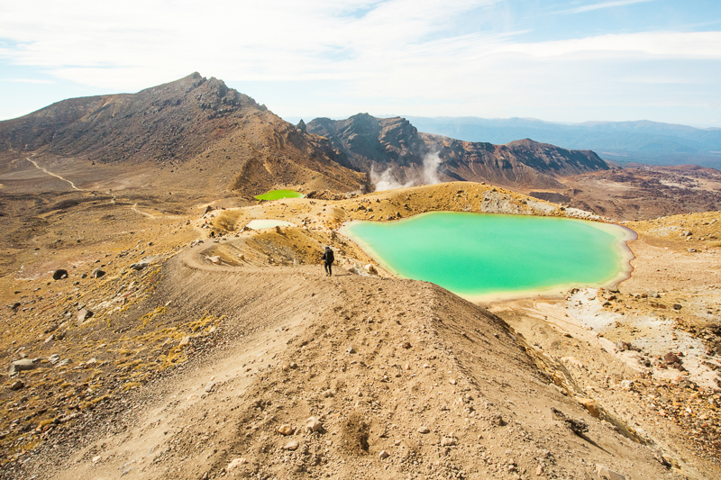
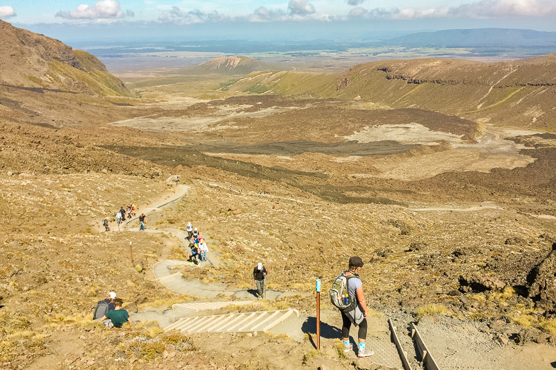
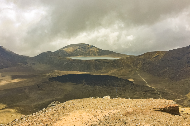
If you make it to Red Crater without any issues the rest of the track is much easier.
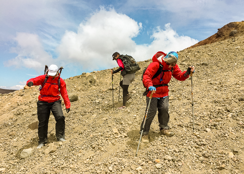
But there’s still a steep and technical descent down a scree slope to the Emerald Lakes.
This scree slope is the most common cause of falls and injuries on the track so take your time, dig your heels in for more traction and consider using trekking poles for more stability.
Here are some suggested times to complete the remaining parts of the track:
- Red Crater to Emerald Lakes: 45 min to 1 hr (750 m / 0.5 mi)
- Emerald Lakes to Blue Lake: 30 min – 45 min (1 km / 0.6 mi)
- Blue Lake to Ketetahi Shelter: 45 min to 1 hr (3 km / 1.8 mi)
- Ketetahi Shelter to Ketetahi Carpark: 1hr 30min to 2 hr (6.4 km / 4 mi)
Tongariro Crossing Facilities.
There are very limited facilities on the Tongariro Crossing track so make sure you’re well prepared for your hike.
Aside from toilets, there are no other facilities (no bins, no shelters, no tap water, no places to buy food or drink) along this route.
Toilets
There are toilets in the following locations along the Tongariro Crossing:
- Mangatepopo Carpark
- Mangatepopo Hut
- Bottom and top of Devil’s Staircase
- Blue Lake
- Ketetahi Shelter
- Ketetahi Bushline
- Ketetahi Carpark
Be sure to pack some extra toilet paper – the track is so popular that toilets may run out. Avoid toileting on the side of the track due to the sensitive nature of the terrain. Please use the toilets provided when you come across them.
Food, Water & Rubbish
You must take all of your own food and water and pack out all your rubbish. Although there are some lakes and streams on the track, it’s not safe to drink from them. Pack at least 2-3L of water per person. You’ll be going through water quickly because there’s no shade until you reach the Ketetahi bushline (less than an hour from the end).
Lakes and streams running from Mt Tongariro are tapu (sacred) to the local iwi. Please don’t touch the surface of the water or swim in lakes.
Shelter
Except for Mangatepopo Hut (30-40mins from the start) there is nowhere to shelter along the track. Pack the right clothing (layers), plenty of sunscreen, hat and sunglasses and perhaps take an umbrella to shelter from the strong sun and UV rays.
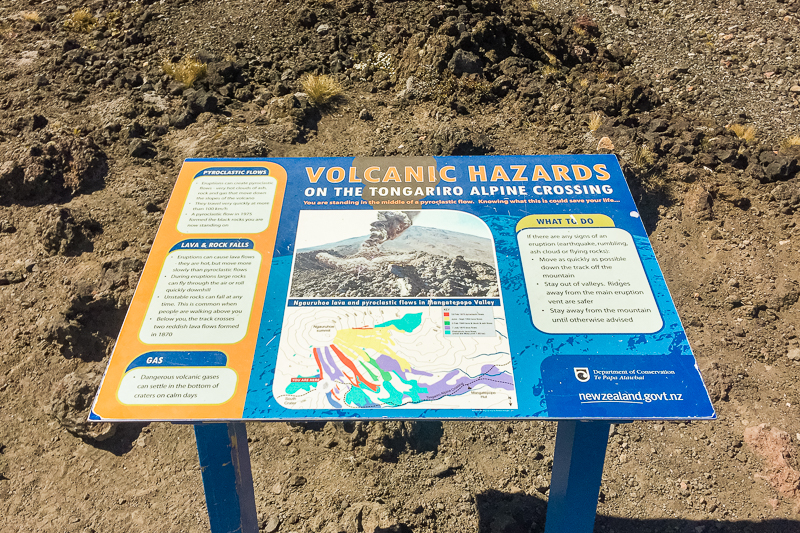
Hazards on the Tongariro Crossing.
The Tongariro Crossing is widely known as one of New Zealand’s most stunning treks. But it also has the highest rate of search and rescue operations of any track in New Zealand. You must take into account certain hazards when planning your trip.
Here are some of the potential dangers you might encounter:
Weather
The weather on the Tongariro Crossing can change rapidly and unexpectedly. High winds, freezing temperatures, low visibility and snow are common (even in summer). If you find yourself in bad weather, it’s best to turn back and try another day.
Check the Tongariro Alpine Crossing weather forecast in the days leading up to your trek. Also check in with the rangers at the Tongariro National Park Visitor Centre the day before your planned trip to get the most accurate and up to date information.
Steep & Rough Terrain
The Tongariro Crossing is a demanding trek with many areas of steep inclines and descents, as well as rocky and uneven paths. Poor conditions can cause the terrain to become slippery or visibility to decrease. Hikers need to be mindful of their footing and take extra care not to lose the trail in bad conditions. If at any time you find yourself battling to locate the trail or stay on track, turn back.
Scree Slope
The descent from Red Crater is a steep scree slope. This slope is the number one cause of falls, injuries and rescues on the track. Here are some tips for negotiating this slope safely:
- Take your time. It could take up to an hour to descend this slope.
- There are areas of deep and shallow scree. Try to aim for the deeper areas.
- Face down the hill and dig in your heels for better traction.
- If you’re not sure on your feet, use the same technique but take a zig-zag route down the slope or come down sideways (this will also help your knees and stop you getting so tired).
- Use trekking poles for more stability.
- Stay away from the edges of the slope as the hill is more unstable here.
- Try to avoid getting close to larger rocks in case you slip and fall.
- Where the scree is shallower, small stones sit on top of the compacted surface and act like marbles. Try to scuff your feet along to remove the top layer of stones before putting your full weight on your foot.
- Take breaks and don’t be afraid to ask other hikers for help if necessary (I did the first time I did this track!).
Lava Fields & Volcanic Hazard
The Tongariro Crossing’s lava fields are hazardous and difficult to traverse. Lava fields are beautiful to look at, but contain thousands of sharp rocks which can be dangerous.
Beware also of geothermal steam vents which not only cause severe burns but also make the surrounding land unstable. Eruptions can occur at any time, even though the track is open. Check the Volcanic Alert Level and talk to the rangers at the Tongariro National Park Visitor Centre before your hike. When you’re out there, stick to the marked trails at all times to avoid putting yourself in unnecessary danger.
Make sure you are well-prepared for the trek with proper clothing, supplies and equipment before starting your journey. Never be afraid to turn back at any point. You can call your shuttle company from the Mangatepopo carpark and ask them to pick you up earlier if necessary.
Lord of the Rings and Mount Doom Tourism.
The Tongariro Crossing takes hikers right past Mount Ngauruhoe which was the filming location for the Mordor and Mount Doom scenes in the blockbuster hit movie trilogy the Lord of the Rings.
Movie tourism brings hundreds of thousands of international hikers to the Tongariro Crossing each year, specifically to the slopes of Mt Ngauruhoe where they can get that all-important selfie to prove they have hiked to the top of Mount Doom.

➤ LORD OF THE RINGS FAN?
How to Climb New Zealand’s Mount Doom (Mt Ngauruhoe)
This is causing major problems. More hikers on the mountain means more erosion and damage to the natural environment. It’s also a very unsafe climb (especially for inexperienced hikers) and many have had to be rescued due to injuries caused by slips or falls, or from falling rocks dislodged which have become dislodged on the climb.
But more than that Mt Ngauruhoe (as well as nearby Ruapehu and Tongariro itself) is a sacred mountain to local Māori tribes who see standing on the summit as deeply disrespectful. It’s this fact which saw the removal of signage marking the tracks to the summit of Mts Tongariro, Ngauruhoe and Ruapehu in 2017.
Rangers are now stationed along the track to advise people to respect the mountains by not climbing to their summits. Please respect this advice and our mountains by sticking to the marked tracks only.
Tongariro Crossing Accommodation.
With plenty of Tongariro Crossing accommodation options available in Taupō, Tūrangi, National Park village and even at Whakapapa Village (base of Mt Ruapehu), you can find the perfect place to stay before your Tongariro Crossing hike.
At Whakapapa Village you’ll find a host of Tongariro Crossing accommodation options, from camping to luxury lodges and everything in between.
Whakapapa Village is home to the Tongariro Holiday Park, which offers powered sites for caravans and campervans, as well as a range of rooms and cabins. Tongariro Crossing shuttle companies can pick up from Tongariro Holiday Park so you don’t have to worry about finding your own way to the Tongariro Crossing trailhead.
Find the perfect Tongariro Crossing accommodation for your pre-hike stay today!
Tongariro Crossing Guided Walk.
A Tongariro Crossing Guided Walk could be the perfect option for beginner hikers as it provides a safe and supported opportunity to explore the Tongariro Alpine Crossing. Knowledgeable guides will provide you with information about the plants and wildlife, geology, and cultural significance of the area.
Experienced guides will provide you with tips on how to stay safe while traversing the Tongariro Alpine Crossing, and they’ll be able to answer any questions you may have about the Mt Tongariro area.
➤ NOT SURE IF A GUIDED WALK IS RIGHT FOR YOU?
Why You Need to Take a Tongariro Crossing Guided Walk
A Tongariro Crossing Guided Walk is also a great way to meet like-minded people who share your love of nature, as well as connect with local Maori culture.
If you’re a beginner hiker who wants to explore Tongariro National Park safely and with confidence and learn from knowledgeable guides and like-minded people who share your love of nature, book a Tongariro Crossing Guided Walk today.

➤ FIND THE PERFECT TONGARIRO CROSSING GUIDED WALK TODAY!
5 Of the Best Tongariro Crossing Guided Tours (+1 Even Pros Will Love)!
Tongariro Crossing Distance.
The total Tongariro Crossing length is 19.4 kilometres (or 12 miles). It’s a challenging hike with steep and undulating terrain that meanders its way over Mount Tongariro, one of NZ’s most active volcanoes.
You can walk the Tongariro Crossing in both directions but it’s much easier (and safer) when walked one way from the most popular starting point at Mangatepōpō to the end of the trail at Ketetahi.
When walking in this direction, you’ll not only be going with the flow of hundreds of other hikers (so there’s more people around if you get into trouble), but you’ll also experience less overall elevation gain making this walk substantially easier.
⚠️ IMPORTANT NOTE ABOUT BOOKING THE TONGARIRO CROSSING ⚠️
For the first time, a booking system was introduced for this track in July 2023. Hikers are now advised to make a booking before walking the Crossing (NOTE: bookings are required if you are taking a shuttle or guided walk). Whilst there is currently no cost for booking, or a daily cap on walker numbers, it’s possible this might be introduced from late 2024 onwards. Click here to find out more and make a booking.
Tongariro Crossing Time.
The Mt Tongariro Crossing usually takes fit hikers between 7-9 hours to complete. But this can vary up to 11 hours or more depending on your fitness level, the weather and the amount of time you spend taking breaks or stopping for photographs.
Generally the Tongariro Alpine Crossing hike is a full day trip which requires an early start in order to cross the mountian before sunset.
Most Tongariro Crossing hikers will start their trek before 8am. If you are catching a shuttle return, keep an eye on the time and your pace so you don’t miss it. Above all else, please remember that it’s still a strenuous hike – so have fun, be safe and enjoy the journey!
Tongariro Crossing Altitude.
The Tongariro Crossing is not for the faint of heart! The highest point on the track is Red Crater at 1,868m / 6,128ft. The elevation change is 1,196 m / 3923 feet so you need a solid level of fitness to safely complete this hike. Before setting off, be sure to check the Tongariro Alpine Crossing website for any warnings, alerts or closures.
Tongariro Crossing Logistics.
The Tongariro Crossing is conveniently located in the centre of the North Island. It’s just a 1 hr drive from Taupō and 30mins from Tūrangi or National Park village. Most hikers prefer to walk from Mangatepopo to Ketetahi as the elevation gain/loss is significantly easier in this direction.
Make sure you’ve arranged your transport to and from the Tongariro Alpine Crossing, or book a Tongariro Crossing shuttle. There are shuttles that depart from Taupō, National Park and Whakapapa Village regularly throughout the day. To guarantee your return transport, make sure you book in advance!
Tongariro Crossing Bookings
From October 2023 Tongariro Alpine Crossing hikers are now advised to make a booking via DOC’s online booking system before embarking on their trek.
Bookings can be made by completing the online form. Make sure to print or save a copy of the confirmation with you. Your shuttle provider or guide will want to see proof of it before you start, and you may be required to present it to rangers along the track.
There’s no need to cancel your booking if your walk doesn’t go ahead, and you can complete a new booking form if you need to reschedule your walk.
At the time of writing, there is no cost or fee associated with the booking, nor is there a daily cap on walker numbers. It’s possible a fee and daily cap may be imposed in the future.
Tongariro Crossing Parking.
The Tongariro Crossing starts and ends in different locations. You need to organise transport for you or your group to and from the start and finish points.
You can drive to the start/end of Tongariro Crossing in your own car. But there’s a 4 hour parking limit at both Mangatepopo carpark and Ketetahi carpark during peak season. Your tires may be clamped if you exceed this limit, so get a taster of the Tongariro Alpine Crossing with one of these shorter walks:
- Mangtepōpō carpark to Soda Springs: 9 km / 5.6 mi (return) | 2hr to 3hr (return)
- Ketetahi carpark to the old Ketetahi shelter: 13km / 8 mi (return) | 3hr to 4 hr (return)
But if you want to hike the whole Tongariro Crossing you can use a park n ride shuttle service from Ketetahi (Cost: NZD$45 pp). This means you can take as much time as you like hiking the track without rushing to catch a return shuttle (more on shuttles below).
Tongariro Alpine Crossing Shuttles.
Whether you’re driving yourself to the track or traveling from one of the nearby main centres, you’ll need a shuttle service to get to and/or from the start or end of the track.
If you don’t have your own car you can book a shuttle from as far away as Taupō or Tūrangi, or as close as Whakapapa or National Park villages. The cost of shuttle increases the further away you get from the trailhead but never exceeds around NZD$100.

➤ TRAVELING TO THE TONGARIRO ALPINE CROSSING?
See my picks of the Best Tongariro Alpine Crossing Shuttles
It’s important to book your Tongariro Crossing shuttle bus in advance – especially during peak season (weekends and school holiday period between mid-Dec and end of Jan).
If you don’t have (or don’t want to use) your own vehicle, round-trip shuttle services are also available.
In my experience all the Tongariro Crossing shuttle companies are very helpful. Call or email them with any questions well in advance if you have concerns.
Best Time to Hike The Tongariro Crossing.
Although the Tongariro Crossing is open all year round, the best time to hike it is during the New Zealand spring, summer and autumn months (November to end of April). During these months, there’s less chance of extreme weather meaning you’ll be a lot safer.
Summer Months (late December to end of February)
During the summer months you’re more likely to have plenty of sunshine, minimal wind and little rain. You’ll be much warmer and safer at the higher altitudes during summer and you’ll also get the best photos!
But with the sun comes high temperatures. There’s no shelter or shade on this track at all. Bring plenty of sun protection (sunglasses, hat, sunscreen, long layers) so you don’t get sunstroke or severely sunburnt. UV rays are much stronger at higher altitudes putting you at greater risk.
Spring and Autumn (late October to mid-December and March to April)
Spring and autumn on the Tongariro Crossing is much cooler but it can also be very wet and windy. There might even still be some snow on the ground at higher elevations.
If you’re planning to hike the Tongariro Crossing during spring or autumn you may have to postpone your hike multiple times whilst you wait for the ideal weather conditions.
Always check the weather conditions in advance (more on this below).
Winter (June to October)
I recommend you don’t hike the Tongariro Crossing during the winter months unless you have mountaineering experience.
If you don’t, the only safe way to walk the track during the winter is with an experienced and reputable guide.
Tongariro Crossing Weather.
Much of the Tongariro Crossing is above 1,100 metres, meaning you’re constantly walking in alpine terrain. Weather can change in an instant – you should expect wind, rain and snow at any time (even in summer). So it’s important to check the Tongariro Alpine Crossing weather forecast before you go.
The first hour of the Tongariro Crossing track is in Mangatepopo Valley and very sheltered. Don’t assume that if the weather’s good here it will be good at the top – take plenty of warm and waterproof layers just in case. If weather is bad or there are strong winds at the top of the Devil’s Staircase you should consider turning around. Call your Tongariro shuttle company from Mangatepopo Carpark to arrange an early pickup.
NIWA, Metservice and the Tongariro National Park Visitor Centre offer up-to-date Tongariro Crossing weather forecasts to help you make an informed decision about whether to tackle the Tongariro Alpine Crossing.
NIWA and the Department of Conservation will issue a ‘Not Recommended Today’ advisory for the track by 6am in the morning if the following conditions are or will be present:
- average wind speed of 55 kph or greater
- wind gusts of 70 kph or greater
- wind chill of minus 10 °C or colder
- wind chill of 0 °C or colder with 1 mm of precipitation or greater
- rain rate greater or equal to 2.5 mm/hr
- snow rate greater or equal to 0.1 cm/hr and/or
- precipitation of 10 mm or greater as a six-hour accumulation between 9 am and 5 pm.
Your Tongariro Crossing shuttle company may cancel your Tongariro Crossing booking if wind speed is forecast to exceed 50km/hr at Red Crater. They’ll get in touch with you to advise if this is the case.
You can consider hiking one of the following nearby tracks if Tongariro Crossing weather is bad or a Not Recommended Today advisory has been issued:
- Tama Lakes Track: 17.6km (return) / 5-6 hrs (return)
- Taranaki Falls Track: 6km (loop) / 2hrs (loop)
Both tracks feature some of the best aspects of the Tongariro Crossing without the danger and susceptibility to weather. This means they are great bad-weather alternatives (although you should still check track conditions at the Tongariro National Park Visitor Centre before you set out).
Tongariro Crossing Guide – What to Pack.
For a safe and enjoyable adventure on the Tongariro Crossing, use this gear guide to make sure you’re well prepared before setting off on your trek.
We recommend taking a 25-35L day pack which contains the following items:
Must-Have Items
- Pack liner
- Water (at least 2-3L per person)
- Lunch & plenty of high energy snacks
- Phone / camera
- Backup battery power for phone
- Toilet paper / tissues
- Rubbish bag
- Sunglasses, hat, sunscreen
- Gloves, beanie, scarf (regardless of weather)
Emergency Items
- Small first aid kit
- Torch / headlamp
- Personal Locator Beacon
- Firestarter / matches
- Emergency shelter
Optional Items
- Trekking poles (optional)
- Lip balm
- Umbrella (optional)
Remember, safety first! Use this list to prepare well for any weather you might experience on the Tongariro Crossing.
Tongariro Crossing Guide – What To Wear.
On the Tongariro Crossing, it’s important to dress appropriately for the conditions and terrain. Choose lightweight layers that will keep you warm and dry in any weather. Layering is key!
Here’s what you should wear (or have in your pack) on this trek:
- Short sleeved hiking top
- Long sleeved hiking top
- Shorts / trousers
- Merino or polypropylene base layers
- Underwear
- 2x pairs of hiking socks
- Fleece (or other mid layer)
- Insulated jacket
- Waterproof rain jacket
- Waterproof rain pants/skirt
- Sun hat
- Hiking boots or trail runners
Tongariro Crossing FAQs
Can you stay overnight on Tongariro Crossing?
No, Tongariro Crossing is a one-day hike and camping is not allowed along the trail. However, there are Tongariro Crossing accommodation options available in Taupō, Tūrangi, National Park village and even at Whakapapa Village (base of Mt Ruapehu).
How long does Tongariro Crossing take?
Most people complete Tongariro Crossing in around seven to nine hours, however this can vary depending on your fitness level and the amount of time you spend taking breaks or stopping for photographs. Generally, the Tongariro Crossing is a full day hike which requires an early start in order to cross the mountain before sunset.
How much does Tongariro Crossing cost?
The Tongariro Crossing is free to do, however there are a few additional costs associated with the Tongariro Crossing. These include Tongariro Crossing shuttles, car parking fees and Tongariro Crossing accommodation. Additionally, if you decide to join a Tongariro Crossing Guided Walk, then there may be a fee associated with that. The Tongariro Crossing Guided Walk is great for beginner hikers and provides additional safety, knowledge and support during your Tongariro Crossing adventure.
Is Tongariro Crossing hard?
Tongariro Crossing can be challenging for some people depending on their fitness level, but with a good level of preparation and research it can be completed safely and enjoyably. Some sections of the track require a high level of physical skill and fitness, and parts of the track may become impassable or dangerous in bad weather. This Tongariro Crossing Guide has been written to equip people with the knowledge and skills needed to tackle the Tongariro Crossing safely and confidently.
What time should you start Tongariro Crossing?
Aim to start your Tongariro Crossing hike between 6am and 8am. This will give you enough time to complete the Tongariro Crossing before sunset. You should also make sure you carry a headlamp in case of emergencies or if you take longer than anticipated. It is important to plan ahead and make sure you are prepared for Tongariro Crossing, so check weather forecasts, prepare a packed lunch and make sure you have all navigational equipment (including a Personal Locator Beacon) before setting off on your Tongariro Crossing journey.
Is there cell phone coverage on the Tongariro Crossing?
There is limited cell phone coverage along Tongariro Crossing so don’t rely on being able to get a signal. The track is well marked so you should rarely need to use your phone for navigation. Switch off your mobile device to conserve battery and consider taking a backup battery supply in case of emergency. To protect yourself in case of emergency, hire a personal locator beacon for your trip. These can be hired easily online, from local outdoor stores (such as Macpac or Hunting & Fishing), shuttle & accommodation providers or even the Tongariro National Park Visitor Centre.
Can you swim on the Tongariro Crossing?
Swimming is not allowed on Tongariro Crossing due to the contaminated nature of water sources along the way and the fact that lakes and rivers on Mt Tongariro are considered tapu (sacred) by local Maori tribes.
Can you wear sneakers on Tongariro Crossing?
It is not recommended to wear sneakers on Tongariro Crossing unless you’re an experienced and fit hiker due to the steep, rocky terrain and potential for slippery surfaces. That being said, due to the long distance it’s important to wear shoes that are comfortable for you. I do not recommend hiking the Tongariro Crossing in brand new boots. While hiking boots or shoes with good grip that provide ankle support are best for Tongariro Crossing beginners, a comfortable pair of trail runners may be a better option in a pinch.
How fit do I need to be to do the Tongariro Crossing?
You don’t have to be a super-fit athlete to do Tongariro Crossing, but you should have decent levels of fitness. Tongariro Crossing can take up to 11 hours, with many parts requiring hiking on steep and rocky terrain. The Tongariro Alpine Crossing is 19.4km long, so you should make sure to do some training, such as regular walks and hikes prior to the Tongariro Crossing to prepare your body for the experience.
Are dogs allowed on the Tongariro Crossing?
No, dogs are not allowed on Tongariro Crossing. Tongariro National Park is a protected area, and dogs are not allowed in the park at all (including at Whakapapa Village). This is to protect the park from any potential pollution caused by dogs, such as pet waste and trampling of vegetation as well as native bird and plant species. For these reasons, it is best to leave your dog at home when you plan on doing the Tongariro Crossing.
Are drones allowed on the Tongariro Crossing?
No, drones are not allowed on Tongariro Crossing due to the fragile nature of Tongariro National Park and the potential disturbance they may cause. Tongariro Crossing is also located in restricted airspace, meaning that any aerial activity is strictly prohibited without a special permit. Helicopters frequently operate on the Tongariro Crossing making it unsafe to fly drones. Leave your drone at home and enjoy Tongariro Crossing in its natural glory.
Do you need to book to do the Tongariro Crossing?
There is now a booking system in place for the Tongariro Alpine Crossing. Bookings are recommended for all hikers, but if you’re catching a shuttle or taking a guided tour a booking is required. Bookings can be made via the DOC online booking form. More information can be found here.
Have I Convinced You Yet?
So, there you have it – everything you need to know about making the most out of your Tongariro Crossing experience! With its unique volcanic landscapes, thrilling hikes and unbeatable views, the Tongariro Crossing is an unforgettable experience that will stay with you for many years to come.
I hope this Tongariro Crossing Guide has given you the necessary information and inspiration to embark on your own adventure! If you liked it, please show your appreciation by leaving a comment below!