
Long White Gypsy uses affiliate links and is a member of the Amazon Services LLC Associates Program. If you make a purchase using one of these links, I may receive a small commission at no extra cost to you. See my Privacy Policy for more information.
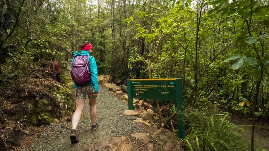
The Sharplin Falls track is quietly surprising. It looks like a quick, easy outing on paper, and it is — but it also fills a gap that a lot of tracks in Canterbury don’t. It’s short, achievable, and reaching the falls bestows a genuine sense of achievement after a reasonably interesting hike.
The first I knew about the Sharplin Falls track was when reels started popping up all over my social media accounts from local creators who were fizzing about DOC’s ‘newest’ family friendly walk in the Canterbury region.
Seeing as how I had only just moved to Canterbury myself, and I was severely lacking in both fitness and knowledge of the local Canterbury hiking and tramping culture, I decided it might be a good track to cut my teeth on.
The more time I spend in the concrete jungle, the more I find myself gravitating towards these quick and easy ‘short’ walks on the lower reaches of the Southern Alps. They bring a much needed feeling of calm and serenity, and reinvigorate the connection to nature I’m always seeking these days.
Track Info
Dogs not permitted
Mountain bikes not permitted
Track Notes for the Sharplin Falls Track
| LOCATION | Staveley, Canterbury |
| TRACK GRADE | Easy |
| TOILETS | 1x long drop at carpark |
| WATER | Stream water on track, but recommend packing 1-2L from home |
| PHONE RECEPTION | Pretty good |
| TRANSPORT | Private car |
| HAZARDS | Steep grades, stairs, rockfall, slippery rocks, streams |
| SPECIAL GEAR | Hiking poles might benefit some walkers |
Track Overview (Quick Facts).
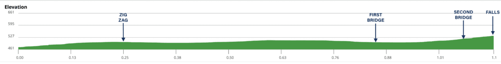
The Sharplin Falls Track is 1.3km in each direction (2.6km / 1.6mi return), with most people reaching the falls viewpoint somewhere between 40 minutes and an hour after leaving the carpark.
The time range depends less on fitness and more on how often you stop — and you probably will, as there’s plenty to see here for both the young and young at heart alike.
The track uses part of the Mount Somers Track, a reasonably popular multi-day walk in this region of Canterbury, most famous for the very popular Woolshed Creek Hut (although the Sharplin Falls Track is not the closest access point to this hut).
More adventurous or experienced hikers may wish to add Sharplin Falls Track on as a side-trip to the Mount Somers summit, which is a much more strenuous track (5.7km / 3.5mi and 3.5 hours one-way) but does use part of the same walkway.
prefer to watch?
Watch my full video from this track by clicking play below.
What the Sharplin Falls Track Is Actually Like.
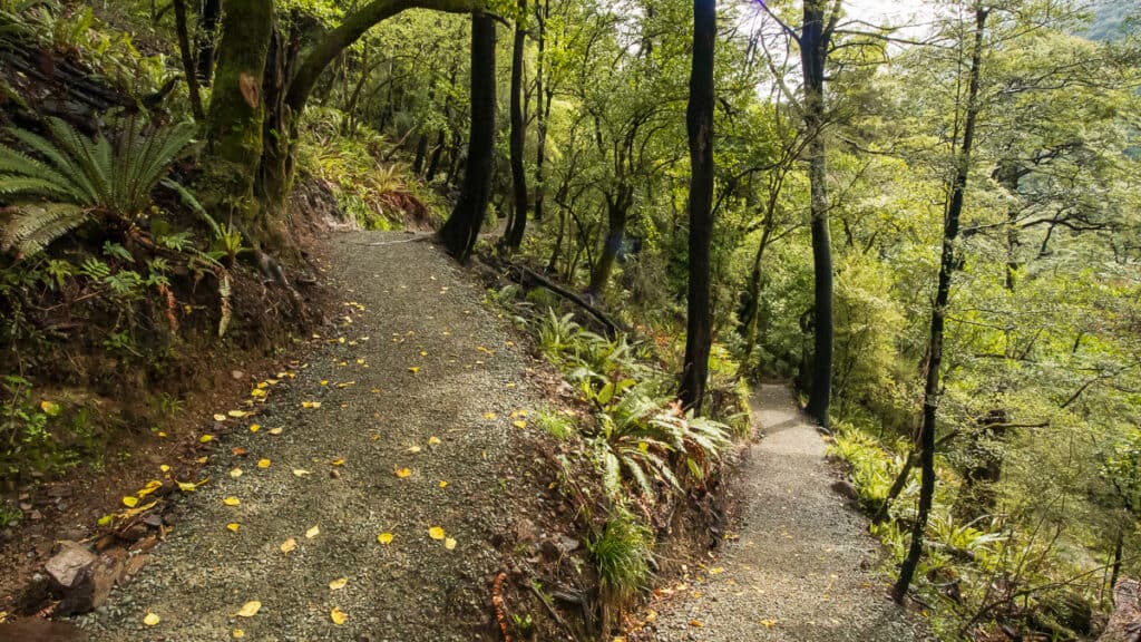
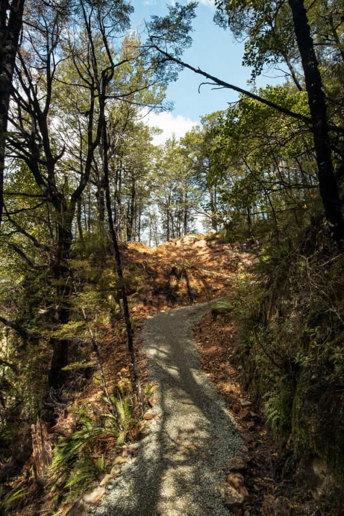
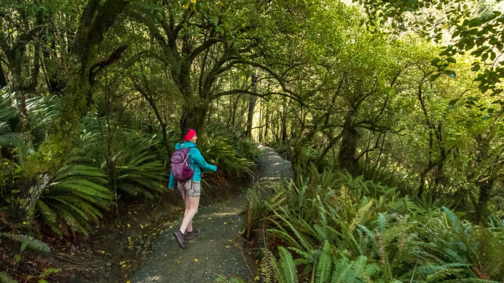
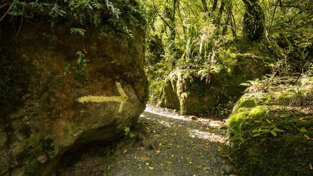
The Sharplin Falls Track is very well formed and easy to follow, but there’s a steady climb throughout that you’ll feel in your legs, particularly if you’re just starting out.
The track starts out with a gentle gradient to ease you into things, before reaching the ‘Zig Zag’ where it drops quite steeply down into a small gully before climbing up out the other side.
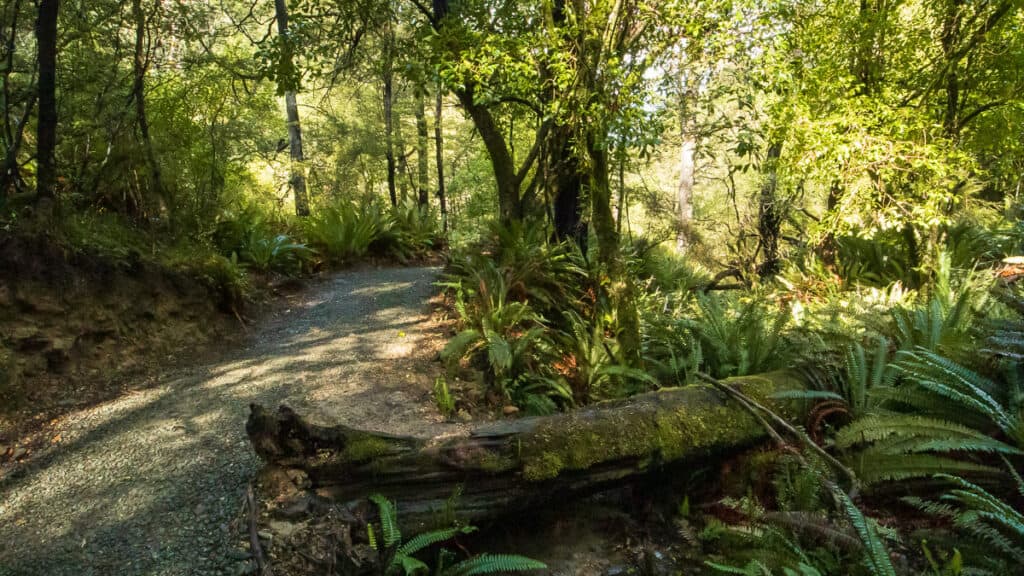
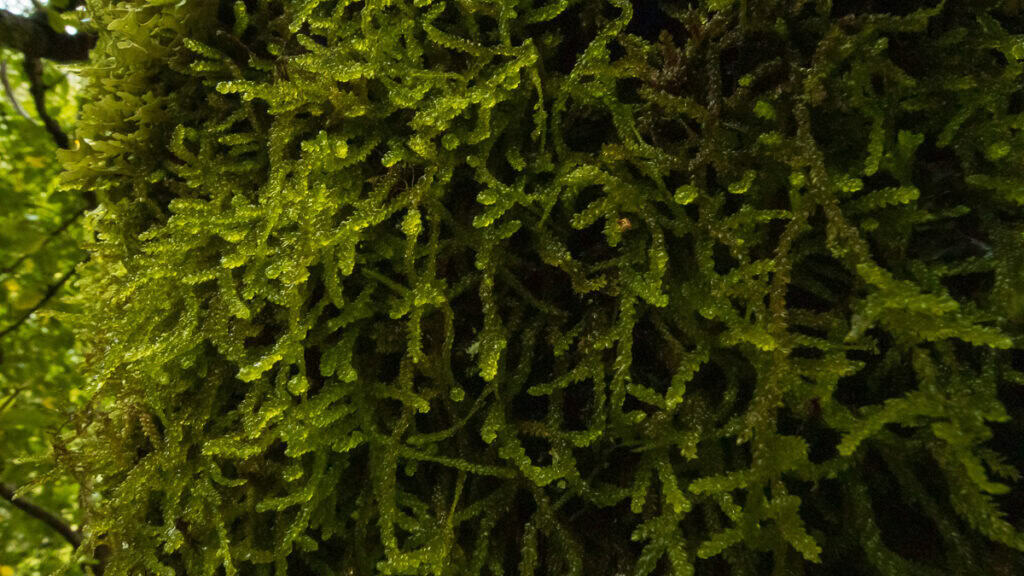
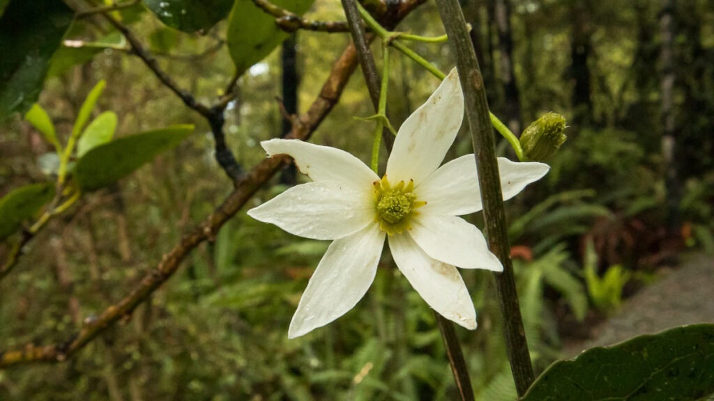
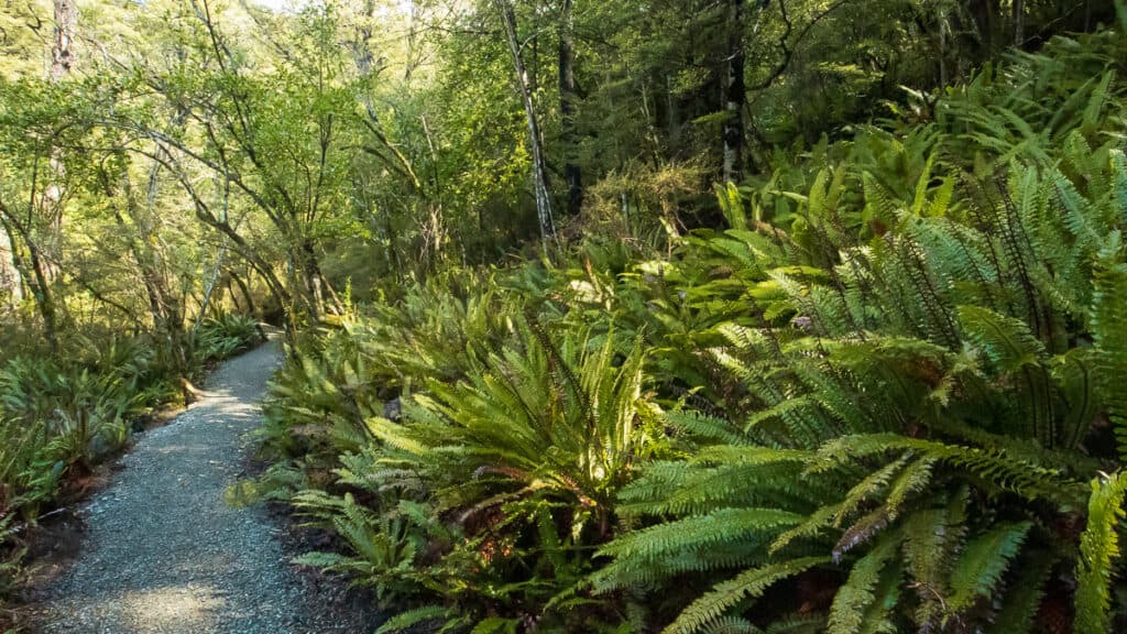
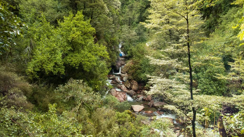
The track continues in this manner, sometimes gently and sometimes not so gently undulating through the beautiful native bush. You’ll see a mixture of beech forest, rāta, plenty of crown ferns, mosses and lichens.
There’s also a good bit of birdlife to watch out for as well, with fantails, tomtits, kereru and bellbirds all commonly found in this reserve.
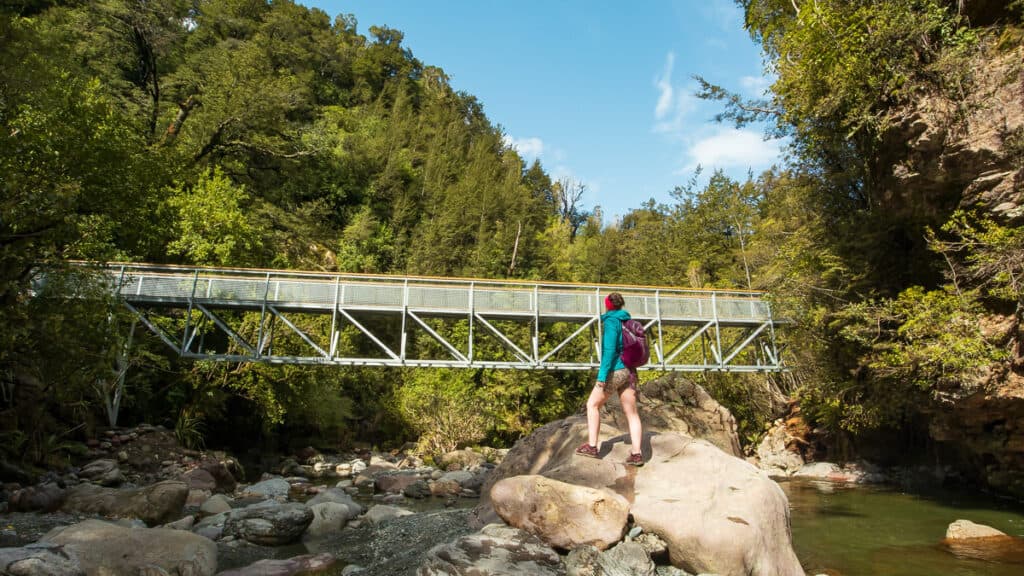
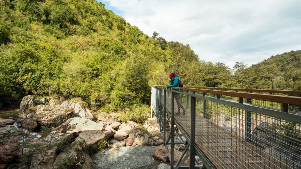
By the time you reach the first of the two bridges, things have evened out somewhat, although the majority of the elevation is gained after this point, mainly via a couple of sets of steep staircases before the final viewpoint.
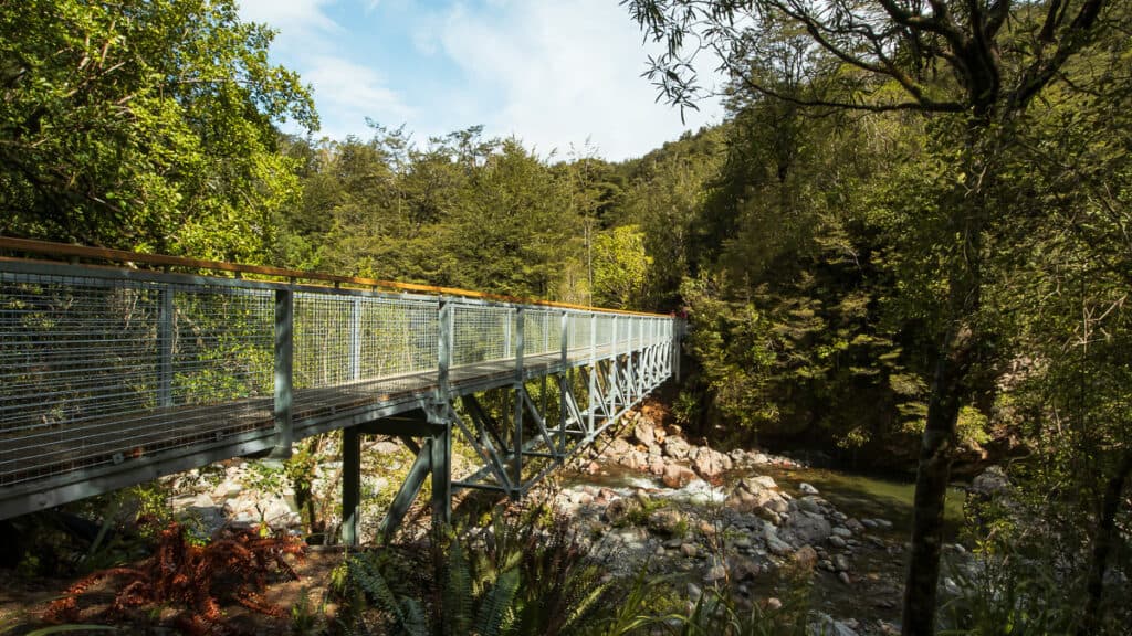
Along the way, make sure to take the side trail down to the stream at the end of the first bridge, and explore some of the rock pools. A gantry walkway around a large rock overhanging the end of the second bridge also reveals a small cave which will be a delight for younger hikers to explore.
Is This Walk Right for You?
Sharplin Falls is a great fit if you’re looking for something simple and achievable, or if (like me) you just need an escape from the hustle and bustle of city life.
It’s a perfect fit for beginners and new solo hikers, as it’s easy to get to, well benched and marked, and there isn’t much danger of getting caught out by rapidly changing conditions.
It’s also excellent for young families or those wanting to expose their children to their first taste of outdoor adventure. The track is made for families with an easy-to-walk gravel pathway and some great points of interest along the way – the track is split into six sections which are helpfully marked out along the way to keep little minds interested:
- the Zig Zag
- Plod
- Clay Cutting
- Grassy Slip
- Rocky Cutting; and
- Broadleaf
If you’re chasing big views, remote backcountry vibes, or a proper physical challenge, this track probably won’t hit the mark for you, but the nearby Mount Somers Summit walk may be more your style.
How Hard Is the Sharplin Falls Walk?
This track sits comfortably in the easy range, but it’s not completely effortless. The path is well graded and maintained the whole way, and there are no particularly technical sections to worry about (although it is a bit steep in some places).
What makes it feel slightly more than “easy” is the consistent uphill. It’s never extreme, but it’s enough that you’ll notice your heart rate climbing.
There is only a relatively tame 80 vertical metres in elevation between the Sharplin Falls car park and the falls viewpoint, but (as with many tracks in Aotearoa, particularly on the South Island) that doesn’t mean it’s a well paced climb to get there. There’s a couple of places where you’ll need to work for it.
Don’t feel bad if you need to stop and catch your breath. In fact, that’s a great opportunity to take a look around.
What to Expect at the Waterfall.
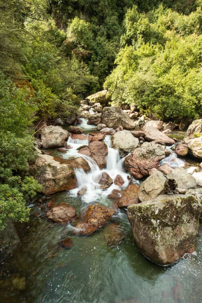
The waterfall itself is nice reward, and there are definitely some good spots around for those who are keen to practice their long-exposure photography.
But it’s worth mentioning that it’s not a massive, dramatic cascade — in dry conditions, it might feel a bit underwhelming.
If you’re after the best results, make sure to come by after it’s rained, when the falls have a lot more presence.
Either way, the viewing platform gives you a comfortable spot to stop, take it in, and reset before heading back. Just make sure to lather on plenty of bug spray to keep those pesky sandflies away!
When Is the Best Time to Visit?
The track is a great one to walk all year round. Because it’s been constructed well it’s possible to walk in almost all weather conditions, even rain if you’re brave enough!
For the best results at the falls, you might want to aim for a day or two after there’s been some decent rainfall. Just bear in mind that the track will be a bit slipperier in places if you’re going after a period of heavy rain.
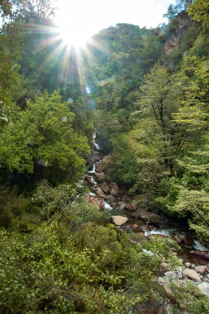
I’d recommend (if you can) you make a beeline for this track before lunchtime, to make the most of the lighting conditions at the falls in the morning. In the afternoon, the sun starts to set behind the hills at the top of the falls, which can present a problem for photos.
Sharplin Falls Directions and Parking.
The track is located in the Staveley Scenic Reserve in the Mount Somers area of Mid Canterbury.
Getting there is fairly straightforward – It takes approximately 90 minutes to reach the track carpark from Christchurch, and about 35 minutes from Ashburton, which are the closest main centres.
The road is sealed all the way to the hairpin bend at the top of Flynn’s Road, then turns to compact gravel for the final stretch.
At the trailhead, there’s a reasonable size car park and clear signage marking the start of the track.
There’s also a basic toilet (there are no toilets along the track, so it’s best to use this before you start your hike) and a small shelter with some benches.
What to Bring.
You can keep things super simple for this walk, but you still need the basics.
- Day pack
- 1-2L of water (there are a couple of streams along the way, but best to bring your water with you)
- Light merino baselayers
- Fleece or mid-layer jacket
- Quick-drying shorts or pants to walk in
- Gloves & a beanie (mainly for winter or damp conditions – there’s not a lot of sun on this track)
- Trail runners or hiking shoes (something with a bit of grip will be better for the gravel track)
- Hiking poles will help with the steeper sections and if it’s been raining a lot
- Small first aid kit and head torch
- Sunscreen & bug spray
- Snacks & lunch
Sharplin Falls Track History.
The Sharplin Falls Reserve was gifted to the Crown by its Pākeha owner, Henry Sharplin, in the early 1900s. Of course, the reserve has a cultural history far pre-dating that, with indigenous Māori tribes who knew the falls as Tāhekura likely passing through regularly 400-500 years ago whilst hunting the now extinct moa.
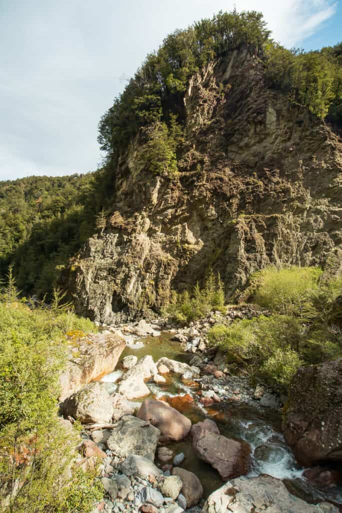
The track you walk today hasn’t always looked like it does now. It used to run on the true left side of the Bowyers Stream under Duke Knob, following the same route as the Mount Somers Track before branching off on a left-hand side trail to get to the falls (in fact, this is whereNZ topo maps still shows the track as running).
In 2010 the track suffered slip damage in the Christchurch earthquakes, and in 2015 rockfall took out a gantry walkway around a rocky bluff which permanently closed the track.
The closure lasted until June 2023 when the track was re-opened after a considerable effort undertaken by the Mount Somers Walkway Society who now manage ongoing maintenance.
The new track now follows the true right side of the stream to avoid the previous issues with rockfall hazards that had plagued the track. You can see the hard work that has gone into the track by the Society, evident by the clear-cut track which is well benched and gravelled for its entire length to make it more durable, for which of course we should be very grateful.
Nearby Walks Worth Adding On.
If you’re already out in the Mount Somers area, it’s worth thinking beyond just this track. There are longer walks nearby if you’re feeling good and want to extend your day. You might want to try out:
Final Thoughts – Should You Do This Walk?
Sharplin Falls is one of those tracks that does exactly what it promises — nothing more, nothing less. It’s short, well-formed, and gives you just enough of a climb to feel like you’ve earned the reward at the end.
If you’re new to hiking, easing back into it, or just need a quick reset in nature, this is a great place to start. It’s approachable, low-risk, and still interesting enough to hold your attention the whole way.
If you’d like to know more about this track, or want some help planning your next trip, reach out to me here.